
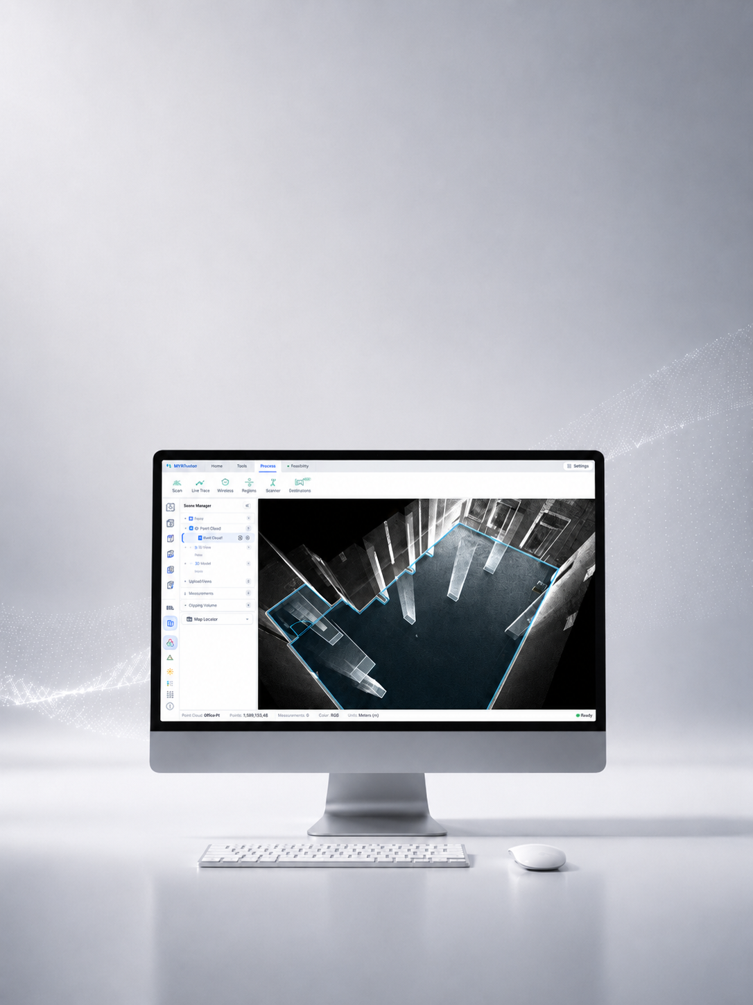
MVPStudio
A Windows desktop application for processing raw scan data into CAD, GIS, and survey-ready deliverables.
Start Free. Unlock Professional When You Need It.
Choose the Edition That Fits Your Workflow
Standard — Free to Use
Open and navigate point clouds; import and export LAS/LAZ; convert coordinates; measure points, distances, heights, areas, and angles; calculate cut, fill, and net volume; review checkpoints and profiles; clean, clip, and segment data; create ortho images; and generate reports.
Professional — Advanced Delivery
Everything in Standard, plus CAD drawing and DXF export, section tracing, structure and wall extraction, pole extraction, Shapefile export, terrain ground classification, DTM and contours, line tracing, Floorplan Studio, and point cloud registration.
MVP S1 raw-data solving is not a third software edition. It is enabled by the separate S1 processing dongle and can be used alongside either MVPStudio Standard or Professional.
From Point Cloud to Finished Deliverable
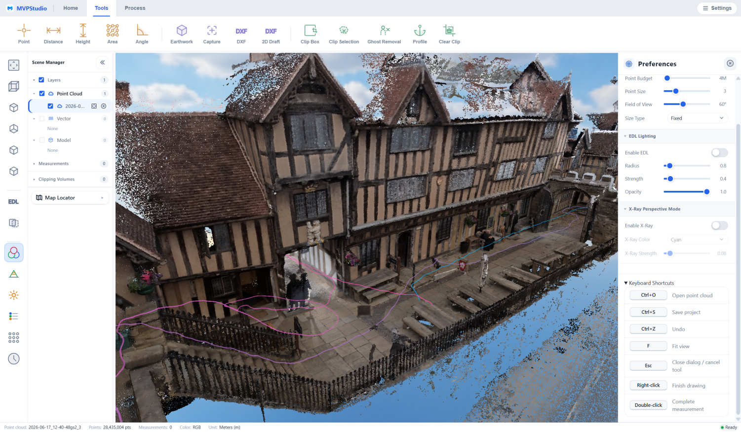
Open, inspect, and organize point clouds from any scanner.
Bring LAS or LAZ point clouds into a local desktop workspace, navigate large scenes, review the available imagery and attributes, and prepare the data for measurement, cleanup, coordinate conversion, or export.
- LAS and LAZ import from Tersus or third-party scanners
- 3D navigation, selection, clipping, and region management
- Coordinate reference system and height conversion tools
- Local Windows processing with no cloud upload
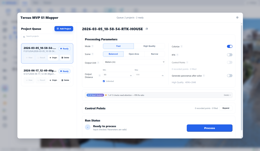
Turn MVP S1 raw scans into a working point cloud.
MVP S1 Mapper guides operators through project selection, processing configuration, monitoring, and results. It reconstructs S1 raw sensor data into a colorized, level point cloud while preserving the georeferencing needed for downstream work.
- Fast and High Quality processing modes
- Balanced, Open Area, and Narrow scene presets
- RTK and control point support
- Multi-project queue for unattended batch processing
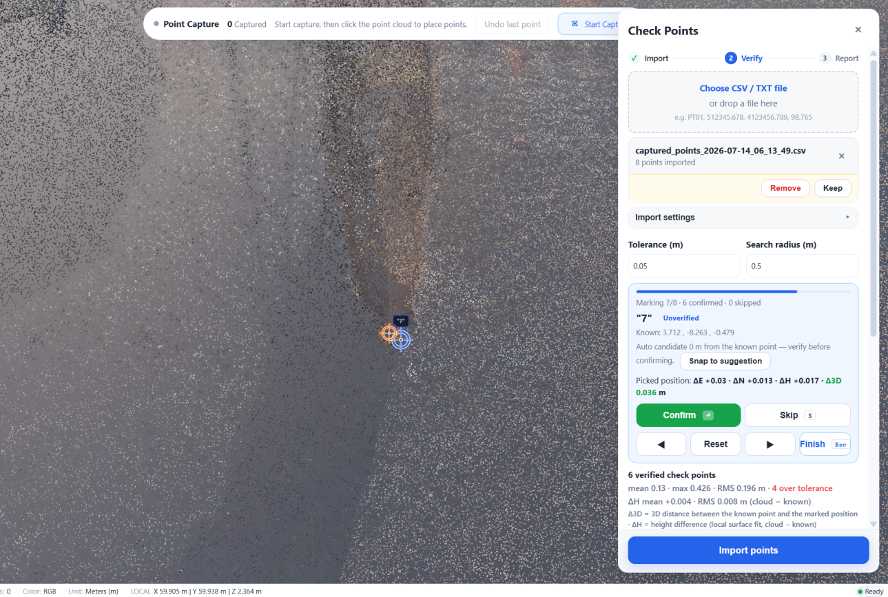
Measure, verify, and document survey results.
Measure directly on the point cloud, import known survey points for checkpoint verification, review live RMS and per-point deviations, and produce reports that document the result.
- Point, distance, height, area, angle, and profile tools
- Meters, feet, and US survey feet
- Checkpoint review and point capture with CSV export
- Accuracy and coordinate transformation reports
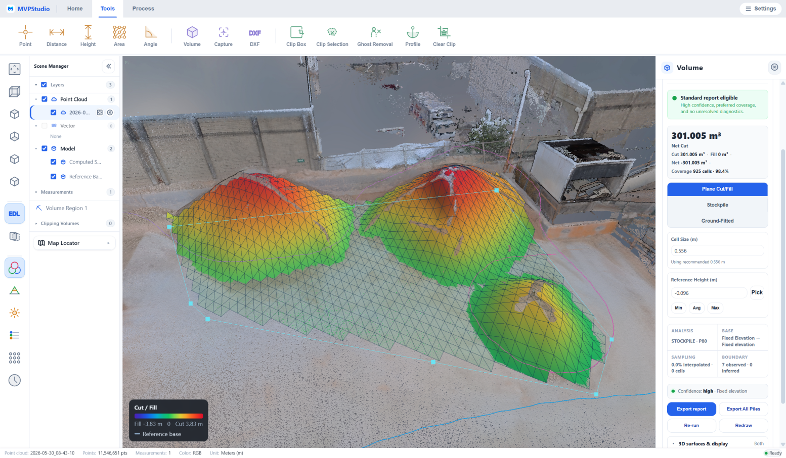
Clean the cloud and calculate defensible quantities.
Remove unwanted points, clip the working area, create ortho images, and calculate cut, fill, and net volume. Visual diagnostics help operators review coverage and support documented volume results.
- Ghost removal, clipping, regions, and point cleanup
- Cut, fill, net volume, and coverage diagnostics
- Profile and section review
- Ortho images and PDF reporting
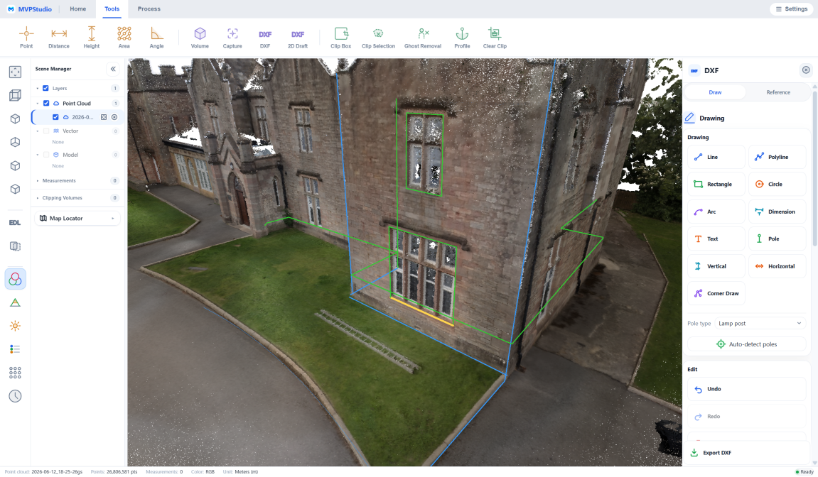
Draw and export coordinate-true CAD and GIS deliverables.
Draft directly over the point cloud, trace sections and structures, and export organized geometry in the real project coordinate system for downstream CAD and GIS work.
- Line, polyline, rectangle, circle, arc, dimension, and text tools
- R12 DXF drawing and export
- Section tracing, structure lines, walls, and pole extraction
- ESRI Shapefile export for GIS workflows
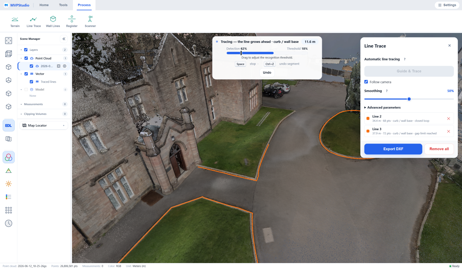
Accelerate terrain, linework, floor plans, and registration.
Professional tools reduce repetitive extraction work while keeping the operator in control. Classify terrain, create DTM and contours, trace linear features, review floor plans, and register point clouds inside one desktop environment.
- Ground classification, DTM, and contour generation
- Assisted curb, wall, marking, and edge tracing
- Floorplan Studio and pole extraction
- Point cloud registration
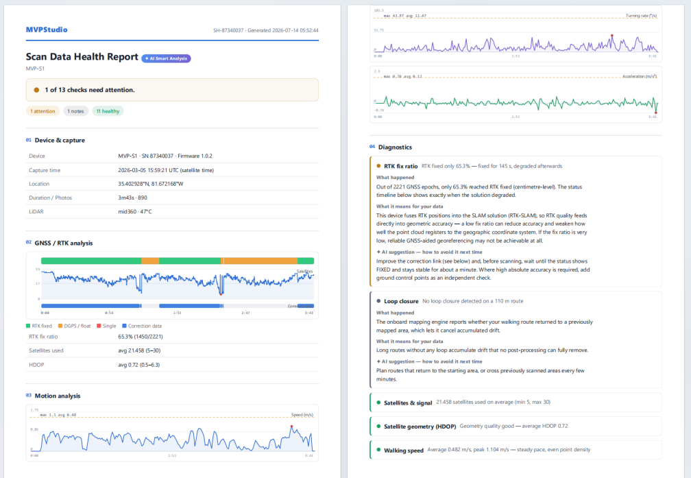
Check scan health before it costs you processing time.
Scan Doctor reviews S1 capture and processed data, explains issues in plain language, and links each finding to practical field guidance. A self-contained PDF report makes the result easy to archive or share.
- Satellite, RTK, motion, loop closure, and sensor checks
- Plain-language findings and recommendations
- Green, yellow, and red trajectory status
- Shareable Scan Data Health Report
Built for Real Survey and Mapping Work
Survey & Mapping
Measure, verify, transform, and deliver point cloud data in the coordinate reference system required by the project.
Buildings & Floor Plans
Extract walls, openings, room structure, sections, and CAD-ready floor plan geometry from indoor scans.
Earthwork & Construction
Calculate cut and fill quantities with Standard, then use Professional for terrain classification, DTM, and contours.
Mobile Mapping
Use Professional to trace curbs and structure lines, extract poles, and export CAD and GIS data for road and city projects.
How MVPStudio Works
Open an existing LAS/LAZ point cloud and go straight to viewing, measurement, cleanup, and delivery. For MVP S1 raw projects, use the separate S1 processing dongle to complete the Solve step first. Coordinate conversion is applied only when the target project system requires it, and export availability depends on the edition.
Typical Workflow
Supported Output Formats
Download, Licensing & System Requirements
Download Free Standard
Recommended PC
Trial, Purchase & Maintenance
Activation & License Transfer
Download MVPStudio & Product Resources
Download, Trial, Purchase & Product FAQs
What is MVPStudio?
MVPStudio is Tersus Windows desktop software for viewing, measuring, cleaning, transforming, and delivering point cloud data. Professional adds advanced CAD, GIS, terrain, extraction, floor plan, and registration tools.
Is MVPStudio Standard really free?
Yes. Download and install MVPStudio Standard and use the included tools without a license code. It does not expire.
What does MVPStudio Professional add?
Professional adds CAD drawing and R12 DXF export, section tracing, structure and wall extraction, pole extraction, ESRI Shapefile export, terrain ground classification, DTM and contours, line tracing, Floorplan Studio, and point cloud registration.
How does the 15-day Professional trial work?
Complete the trial request form on this page. After review, the Tersus team will email a 15-day Professional license key and activation instructions.
What happens when the Professional trial ends?
Professional features stop being available unless you purchase a license. The free Standard Edition remains available and can continue to be used without a license code.
How do I buy MVPStudio Professional and check the current price?
Click Buy Professional on this page to open the secure checkout and view the current price. The purchase provides a perpetual Professional license with the first year of maintenance included.
How do I activate MVPStudio Professional?
MVPStudio supports online and offline Professional activation. The license email and user manual provide the activation steps for both methods.
Can I move my Professional license to another computer?
Yes. Return the license on the old computer before activating it on the new computer. If the old computer is unavailable, contact Tersus support for assistance.
Can MVPStudio open point clouds from other scanner brands?
Yes. MVPStudio can open LAS and LAZ point clouds from other brands. Imported point clouds can skip the MVP S1 raw-data Solve step.
Is MVP S1 raw-data processing included in the MVPStudio license?
No. Processing MVP S1 raw data requires the separate S1 processing dongle. This access is independent of the MVPStudio Standard or Professional software license.
Does MVPStudio require an internet connection?
Normal point cloud processing runs locally and does not require cloud upload. Professional can be activated online or through an offline activation workflow.
Which output formats are available?
Standard includes LAS/LAZ point cloud output, CSV data, ortho images, and reports. Professional adds advanced CAD, GIS, and terrain deliverables such as R12 DXF, ESRI Shapefile, GeoTIFF, and contours. Exact availability depends on the selected workflow.
What computer is recommended?
Tersus recommends Windows 10 or 11 (64-bit), an Intel Core i7-10700H or equivalent CPU, an NVIDIA RTX 2060 with 4 GB or better, 32 GB RAM, and an SSD with at least 64 GB free.
Start Your 15-Day MVPStudio Professional Trial
Try every Professional CAD, GIS, terrain, extraction, floor plan, and registration tool for 15 days. MVPStudio Standard remains free and requires no license code.
Submit the form to request a 15-day Professional license. After review, our team will email the license key and activation instructions.