MVP B1
A dual-wavelength airborne LiDAR for integrated topographic and bathymetric surveying.
Key Advantages at a Glance
Topo-Bathymetric Survey Should Not Be Overcomplicated
Traditional bathymetric LiDAR workflows can be difficult to deploy
High-end airborne bathymetric LiDAR systems have set an important benchmark for data quality, but many real-world hydrographic, reservoir, shoreline, and low-altitude UAV projects require more than premium hardware specifications.
Survey teams often face complex sensor integration, platform adaptation, calibration, data fusion, software compatibility, and long service response cycles. For project delivery, these hidden costs can be just as important as the sensor itself.
MVP B1 makes land-water mapping easier to execute
MVP B1 is designed as a project-ready dual-wavelength airborne topo-bathymetric LiDAR solution. It integrates LiDAR, RGB camera, and POS into a single-body payload, reducing customer-side integration and field preparation work.
With an open and integration-friendly workflow, MVP B1 helps users connect data acquisition, point cloud processing, survey software, GIS platforms, and industry application systems more efficiently.
Professional-Grade Capabilities
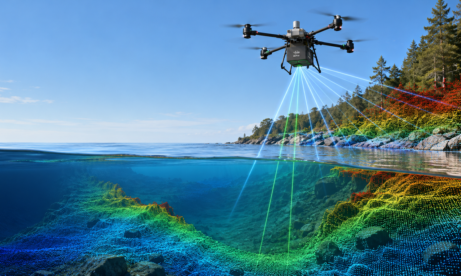
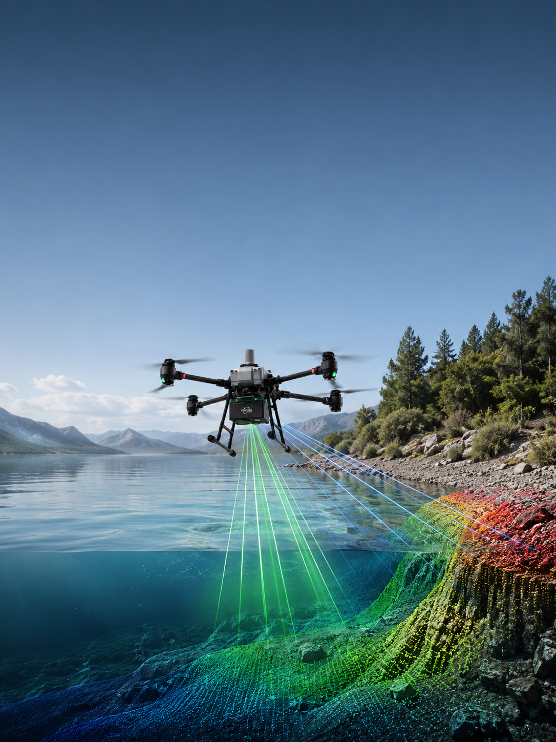
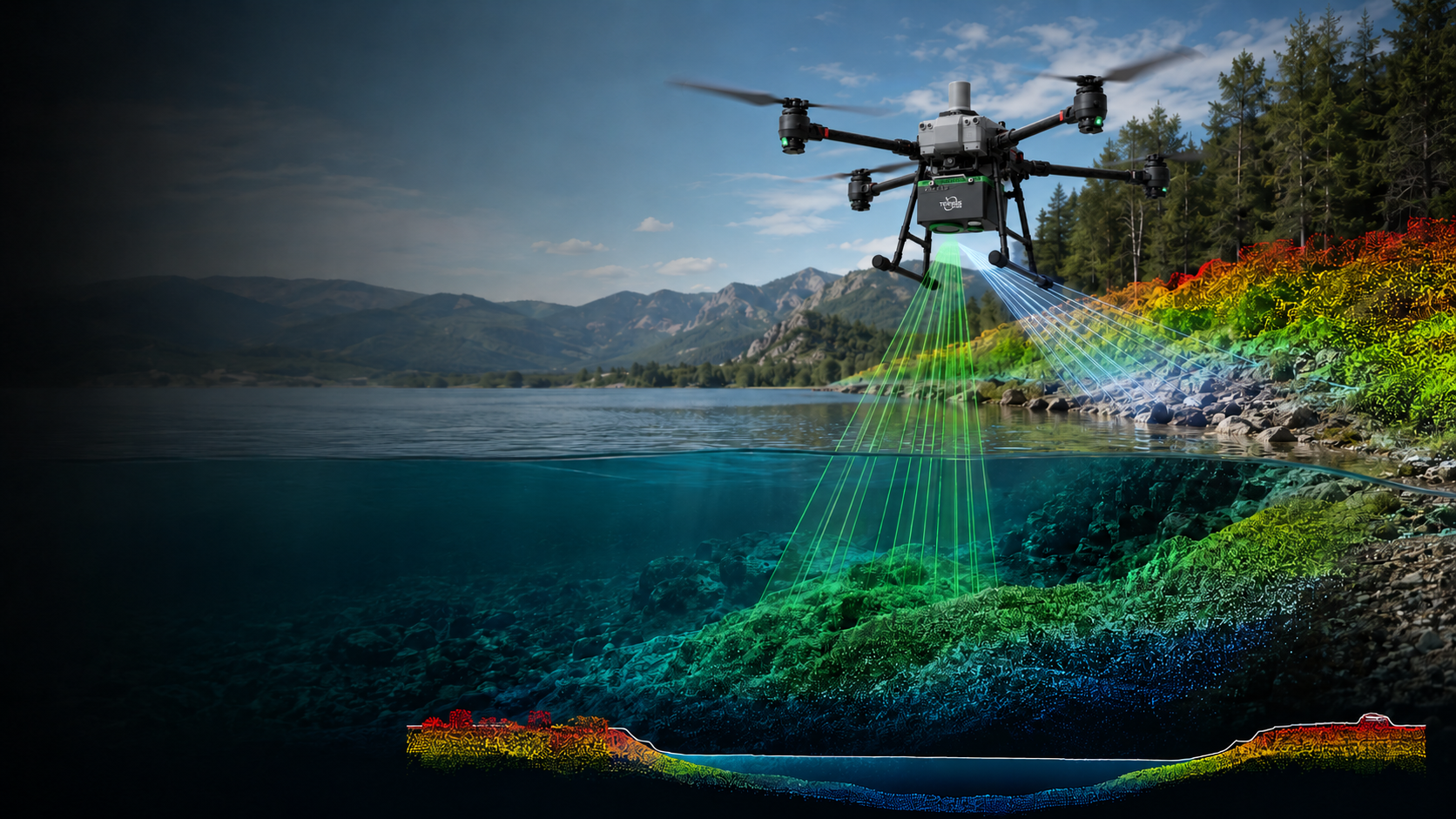
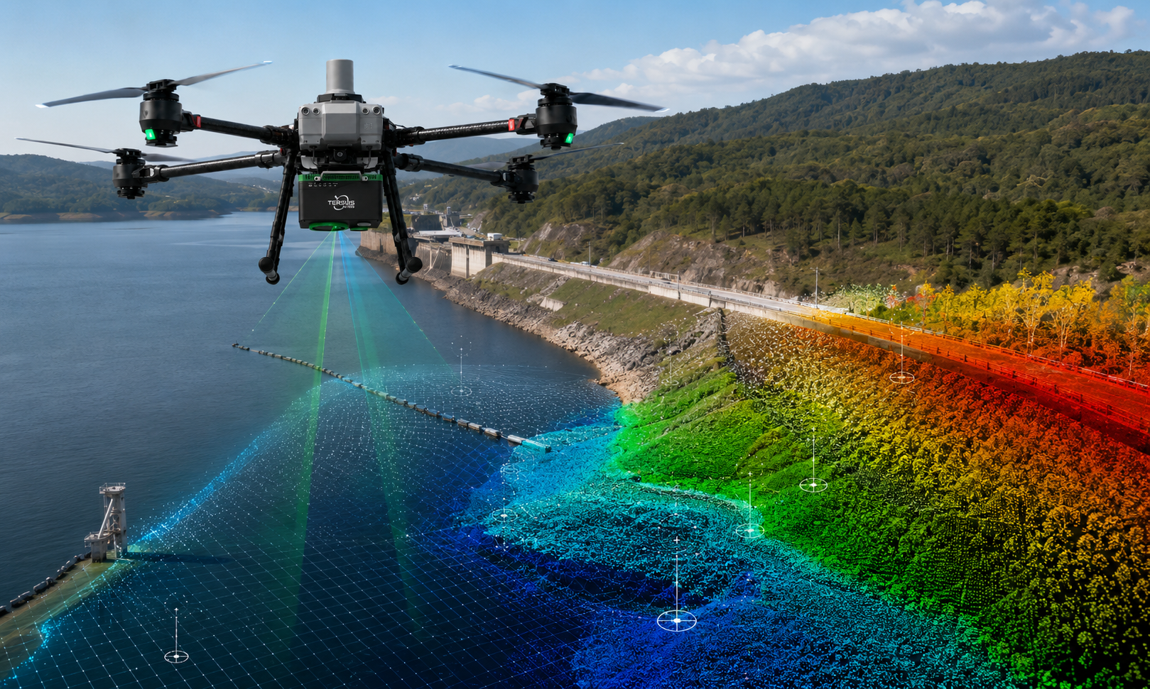
Dual-Wavelength Land-Water Mapping
Capture Land, Shoreline, and Underwater Terrain in One Flight.
MVP B1 combines a 532 nm green laser channel for bathymetric returns with a 1064 nm near-infrared channel for topographic returns. The system also supports water-surface detection for land-water data fusion, helping generate a seamless topo-bathymetric point cloud across shoreline, shallow-water, and underwater terrain.
- 532 nm channel for bathymetric returns
- 1064 nm channel for topographic returns
- Water-surface detection for land-water data fusion
- Seamless topo-bathymetric point cloud
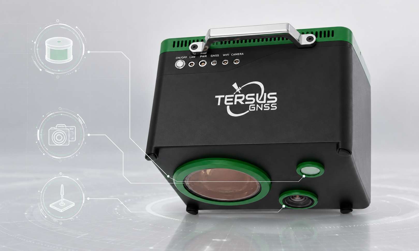
Single-Body Integrated Payload
LiDAR, RGB Camera, and POS in One Factory-Calibrated Unit.
MVP B1 integrates the laser scanner, 12 MP RGB camera, and POS system into one compact industrial payload. This reduces the need for customers to source, mount, calibrate and synchronize multiple independent modules, helping field teams start projects faster and operate with fewer integration variables.
- Integrated LiDAR + RGB + POS
- Factory-calibrated single-body design
- Less customer-side integration work
- More consistent field deployment
Survey-Grade Measurement Performance
High-Precision Laser Measurement for Reliable Survey Results.
With laser measurement precision of 5 mm @ 50 m and support for seven or more returns, MVP B1 provides the measurement foundation required for demanding topo-bathymetric survey tasks. The system supports high-density data capture for reservoir, river, shoreline and engineering survey applications.
- 5 mm @ 50 m laser measurement precision
- ≥7 returns
- 50–300 kHz pulse repetition rate
- 100 lines/s scan line rate
- Cross-track 40° / along-track 28° scanning FOV
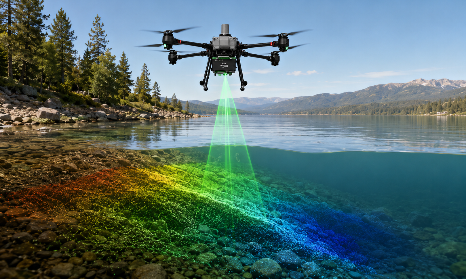
Designed for Shallow-Water Bathymetry
Up to 2.5 Secchi-Depth Water Penetration.
MVP B1 is designed for shallow-water bathymetric mapping where water clarity, turbidity, bottom reflectivity and ambient conditions affect penetration performance. With up to 2.5 Secchi-depth penetration, it supports common inland-water and nearshore survey scenarios such as reservoirs, rivers, channels and shoreline zones.
- 2.5 Secchi-depth penetration
- Optimized for shallow-water survey conditions
- Supports reservoir and waterway mapping
- Helps capture the transition from land to underwater terrain
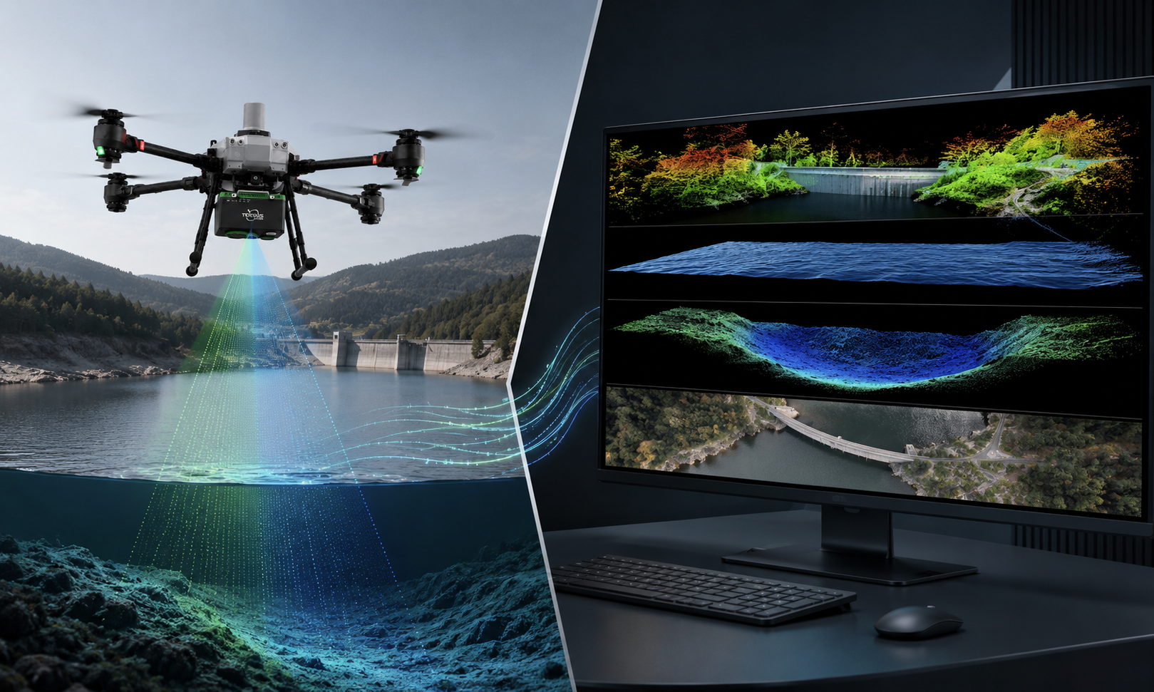
Open and Integration-Friendly Workflow
From Field Data to Survey Deliverables with Less Friction
MVP B1 is built around an open software workflow, making it easier to connect with UAV platforms, survey software, GIS platforms, regulatory systems, and customer-specific business workflows. The system outputs georeferenced colorized point clouds, 1064 nm-derived topographic data, 532 nm-derived bathymetric data, and real-scene RGB imagery.
- Georeferenced colorized point cloud
- 1064 nm-derived topographic data
- 532 nm-derived bathymetric data
- RGB true-color imagery
- Open workflow for survey and GIS integration
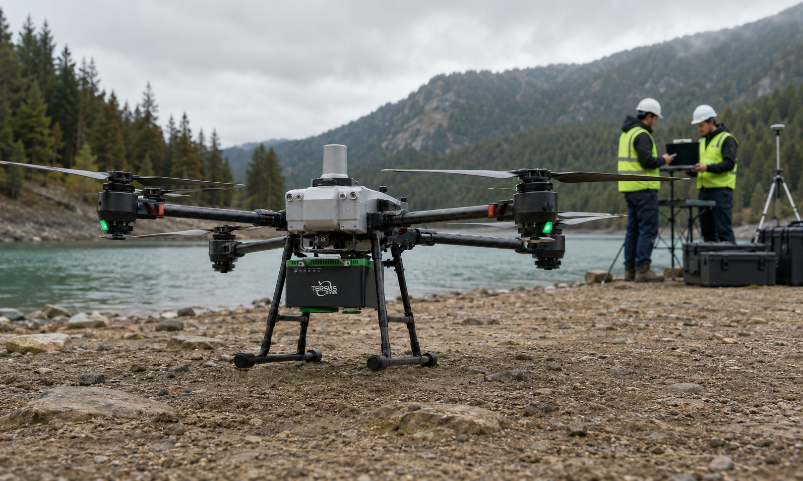
Industrial UAV-Ready Design
Robust Payload for Field Survey Operations.
With a 12 kg industrial-grade body, IP64 protection, 24 VDC power input and Gigabit Ethernet data interface, MVP B1 is designed for professional UAV-based survey deployment. Its compact single-body structure helps simplify installation while maintaining the durability required for outdoor mapping projects.
- 12 kg payload
- 350 × 283 × 232 mm
- IP64 protection
- 24 VDC power input
- TCP/IP, Gigabit Ethernet interface
One Payload. Multiple Land-Water Survey Missions.
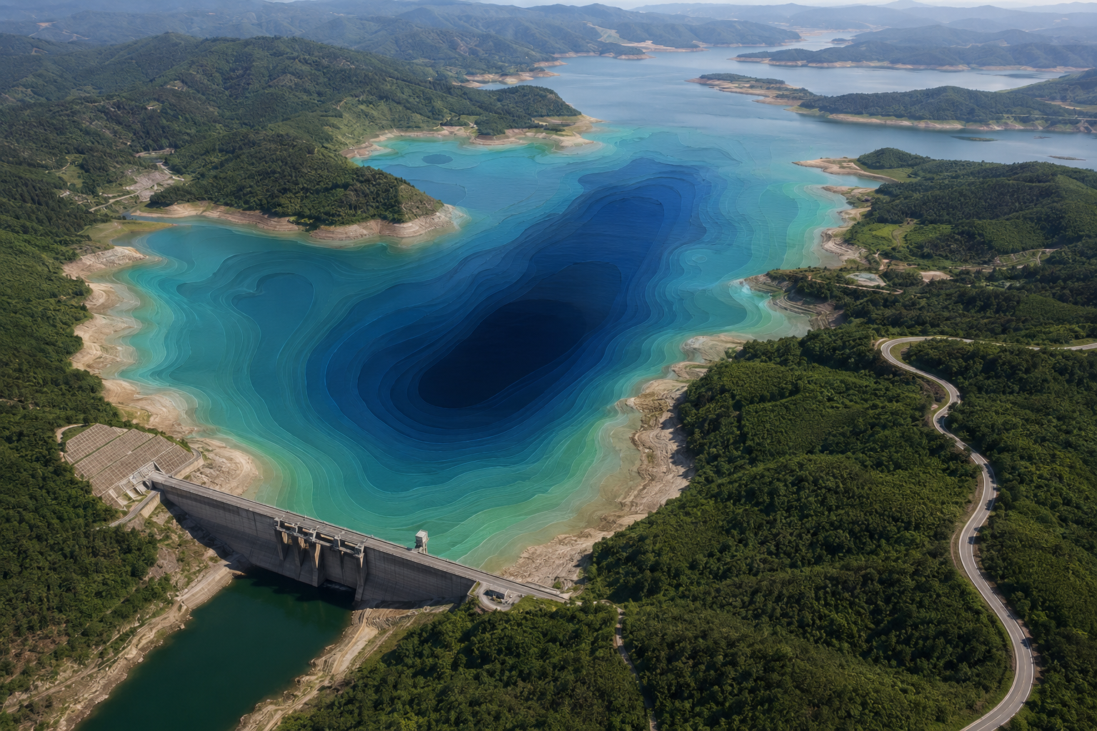
Reservoir Capacity & Sedimentation Survey
MVP B1 helps survey teams capture both exposed terrain and underwater reservoir bed information in one integrated flight. It supports reservoir-capacity analysis, sedimentation monitoring and periodic comparison of changing water storage conditions.
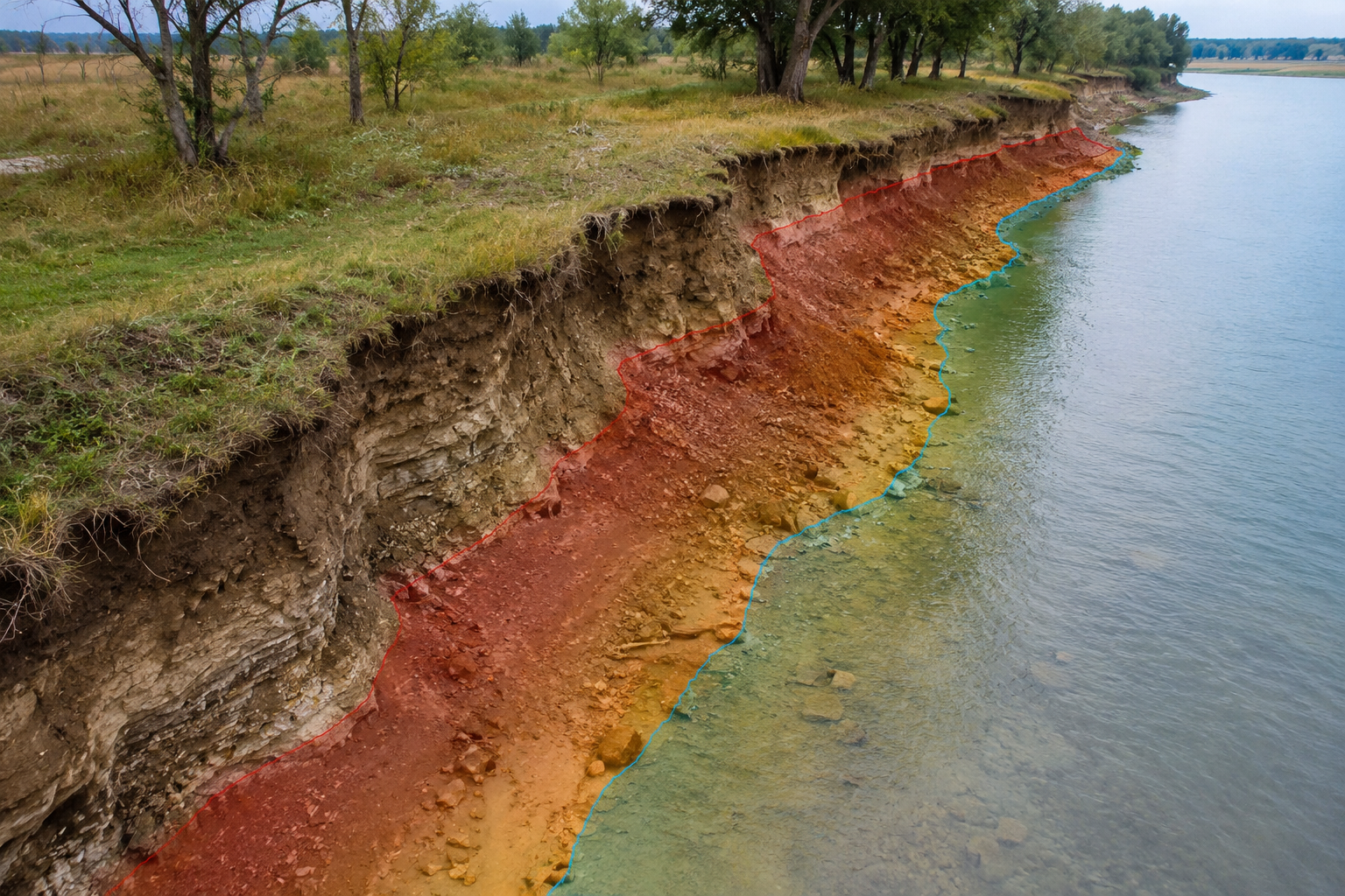
Shoreline & Bank Erosion Monitoring
For shoreline, riverbank and beach erosion monitoring, MVP B1 provides continuous land-water data across the transition zone. Survey teams can better understand how water level, erosion and sediment movement reshape the shoreline over time.
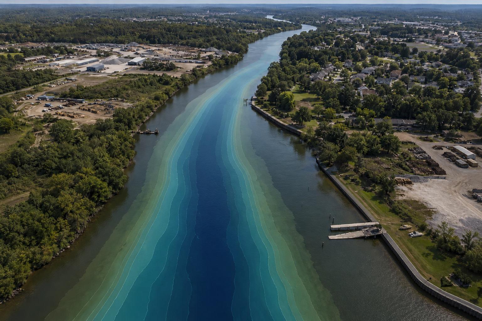
Inland Waterway & Channel Survey
MVP B1 supports river, canal and navigation-channel survey projects where shallow-water bathymetry and adjacent land features must be captured together. The system helps improve data continuity for engineering planning, dredging assessment and channel monitoring.
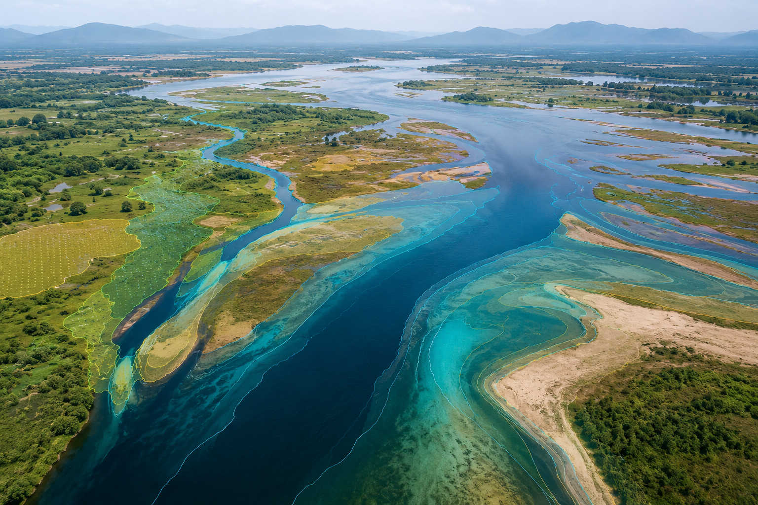
Hydrological & Water Resource Mapping
For hydrological investigation, water-resource management and environmental monitoring, MVP B1 enables efficient 3D data acquisition across lakes, reservoirs, rivers and shallow-water zones, helping users generate data products that support analysis, planning and decision-making.
Technical Specifications
Optical Parameters
System & Data
Physical
Power and Interface
Deliverables
Laser Measurement
RGB Camera
POS
Product Resources
Frequently Asked Questions
What kind of projects is MVP B1 designed for?
MVP B1 is designed for UAV-based topo-bathymetric survey projects, including reservoir capacity surveys, shoreline monitoring, inland waterway mapping, shallow-water bathymetry, hydrological mapping, and low-altitude UAV survey applications.
Why does MVP B1 use both 532 nm and 1064 nm wavelengths?
The 532 nm green laser is used for underwater bathymetry because it can penetrate the water column under suitable conditions. The 1064 nm near-infrared channel is used to capture water-surface, shoreline, and land information, helping generate a more complete land-water dataset.
What deliverables can MVP B1 produce?
MVP B1 supports georeferenced colorized point clouds, 1064 nm-derived topographic data, 532 nm-derived bathymetric data, and real-scene RGB imagery.
How deep can MVP B1 measure underwater terrain?
MVP B1 supports up to 2.5x Secchi Depth penetration. Actual bathymetric performance depends on water clarity, turbidity, bottom reflectivity, ambient light, and field conditions.
Is MVP B1 only a sensor, or a complete survey workflow?
MVP B1 is designed as an integrated topo-bathymetric LiDAR payload with LiDAR, RGB camera, and POS in one factory-calibrated body. Its open workflow helps users integrate UAV platforms, survey software, GIS systems, and project deliverable workflows more efficiently.
Ready to Build a More Efficient Topo-Bathymetric Survey Workflow?
Talk to our team for pricing, platform integration evaluation, technical support, demo coordination, or distributor cooperation.