GNSS RTK & PPK Solutions for UAVs
UAV & Robotics
Imagine being born to fly with internal centimeter-positioning accuracy. High-precision GNSS positioning brings new opportunities and expands the applications of unmanned aerial vehicles (UAVs). A growing of traditional industries such as survey, logistics and agriculture have been the pioneers of UAVs. Aerial surveying, drone delivery, crop health monitoring, and agricultural remote sensing are currently under the spotlights.
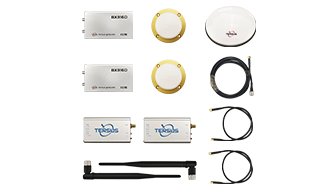
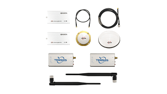
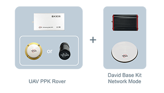
With the Tersus GNSS RTK (Real Time Kinematic) & PPK (Post-processing Kinematic) boards, your drones can fly in a more accurate way and perform more tasks - possibly beyond your imagination.
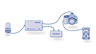
Tersus GNSS OEM boards support multi-constellation (GPS, GLONASS, and BeiDou) and dual-frequency signals. They enable drone-related projects to deliver centimeter-accurate results at an affordable price. Tersus GNSS OEM boards provide either onboard SD card or external add-on storage to support observation data logging and output. They also provide a camera synchronization feature, which allows images to be tagged with precise locations to support efficiency and productivity improvements.