How can MMS optimize surveying?
Lance Dong, Tersus GNSS 5 August, 2022
Over the last decades, with the advancement of positioning technology, the support of multi-sensors and the optimization of processing and computing technology, the surveying methods have conducted tremendous changes. Diverse and complex environments hand huge amounts of data make traditional techniques have to seek help from other sensing technologies, which is exactly how the Mobile Mapping System (MMS) was born.
This new type of surveying and mapping method with strong visualization has attracted a growing interest in different scenarios and has been witnessed as a valuable solution with great potential. For example, MMS proved to be successfully applied in several fields of engineering and research disciplines, such as architectural and urban environment, cultural heritage and archaeology, environmental and engineering monitoring, forestry and agriculture as well as mapping and modelling.
Mobile Mapping System(MMS) is a complete surveying and mapping system, strictly speaking, composed of a data acquisition hardware system and a data processing and mapping/modelling software system. MMS defines a mobile platform that can be either terrestrial or aerial, in which measurement systems and sensors are integrated for the acquisition of geo-referenced metric data.
Hence, MMS is an integration of three hardware components: navigation/positioning sensors, optical sensors and control unit. If it is combined with Light Detection and Ranging (LiDAR) unit, MMS can be referred to as Mobile Laser Scanner (MLS).
The great advantage of this technology is that it can rapidly collect massive amounts of data on a moving platform, which is unmatched by traditional measurement. The laser scanners have been placed on moving platforms in order to obtain multi-position high-rate scan coverage and avoid shadow effects and blind spots as much as possible. The combination of a moving laser sensor and position estimation allows continuous registration and nearly unlimited view angles. The addition of cameras can make up for the lack of RGB information to provide better visual 3D results.
The quality of data observed with the MMS surveys depends on the devices it uses, and can often achieve centimetric accuracy, which however is also affected by the data acquisition speed and the distance from targets.
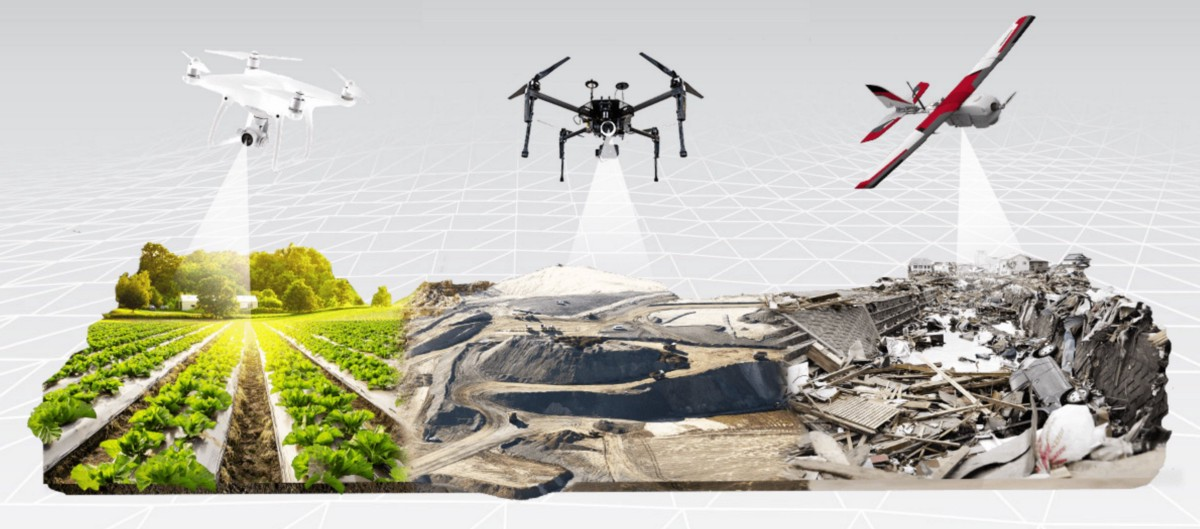
Cr: https://medium.com/soar-earth/how-drones-can-optimize-surveying-and-mapping-projects-3df1100d7e92
Generally, MMS are categorized into terrestrial and aerial mobile mapping systems.
The mobile terrestrial platforms can be divided into human-based, wheel-based, and boat-based.
‘Human-based’ refers to a human-carried platform, commonly referred to as a Portable Laser Scanner (PLS) or a Wearable Laser Scanner (WLS). PLS refers to a small device that is manually carried by the operator, such as a hand-held laser scanner. WLS refers to a device that can be worn by the operator, such as a backpack scanner.
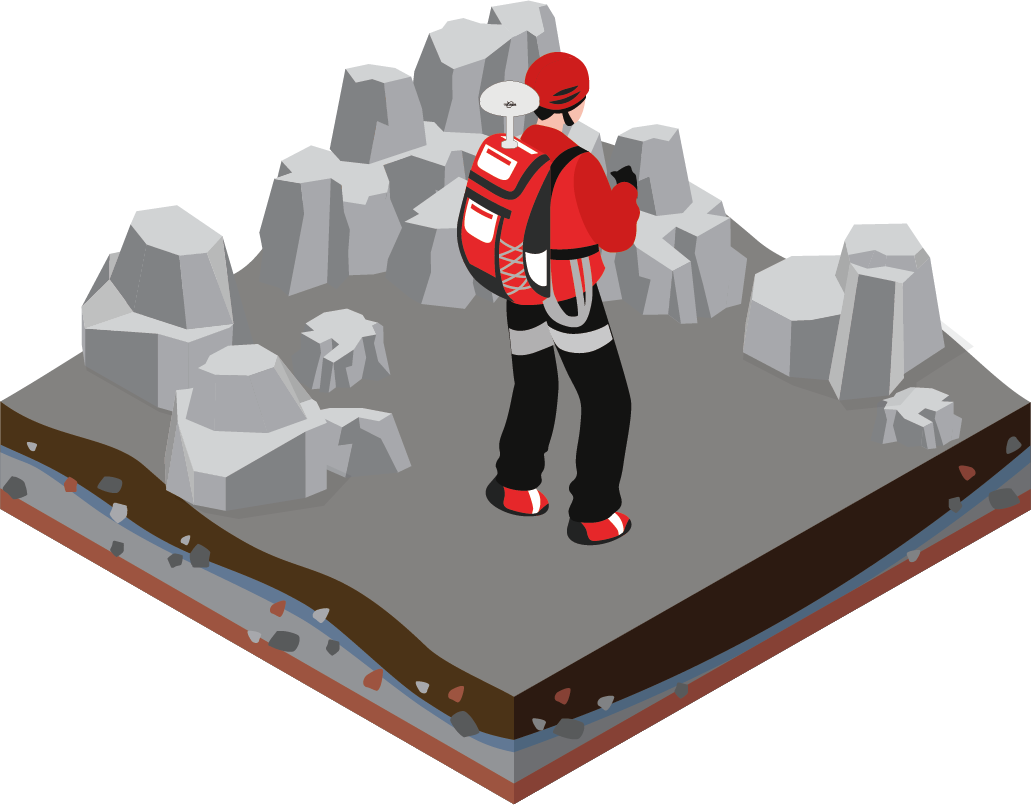
↑ Human-based ↑
‘Wheel-based’ platforms include trolleys, rail vehicles, manned vehicles and unmanned ground vehicles (UGV). Among these, the most common are vehicle platforms and UGV platforms. The ordinary vehicle-mounted system is convenient to drive and operate, while the unmanned vehicles can overcome difficult terrain through remote control or planning paths for scenarios that people cannot easily access.

↑ Wheel-based ↑
‘Boat-based’platforms are only used in certain domains or conditions, like Uncrewed Surface Vessels (USV).
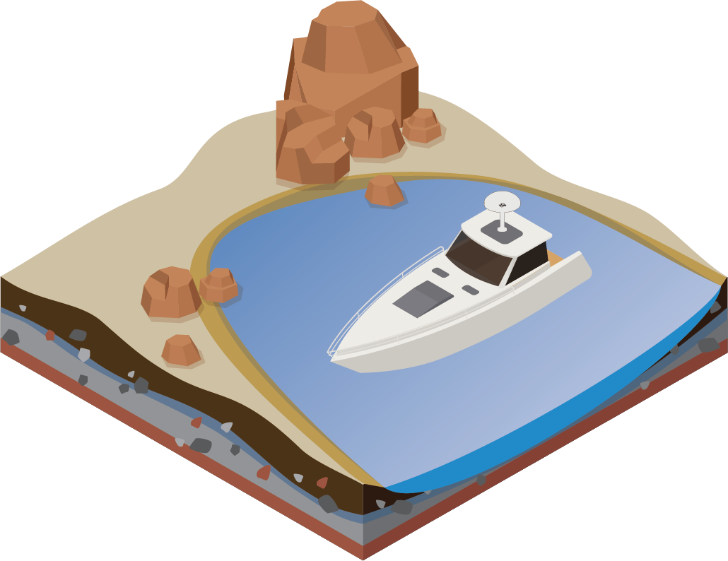
↑ Boat-based ↑
Aerial mobile systems are often referred to as Aerial/Airborne Laser Scanner (ALS), and the laser units on such airborne platforms are usually different from those on terrestrial mobile platforms.
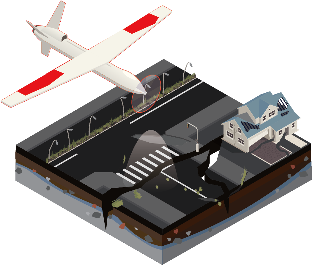
↑ Aerial mobile systems ↑
Firstly, the scanners on airborne often have further scan ranges, due to flight height requirements in some scenarios. Of course, it is difficult for long-range lasers to achieve the accuracy of medium-range lasers. The general-defined effective scan range of the long-range scanners is more than 200m, while the commonly used terrestrial mobile systems and low-altitude UAVs are mostly medium-range scanners, with a general effective range of 80~120m.
Furthermore, due to the particularity of the view angle of the aerial platform, the field of view (FOV) of the scanner used is often different from that of the terrestrial platform. Because terrestrial MMS require a wider FOV to obtain as much point data of surrounding objects as possible in a single drive, they are equipped with scanners with 360° FOV. With the increase in the domains of ALS, the full FOV will also provide higher efficiency.
Therefore we can make the following classification of MMS according to the different platforms.
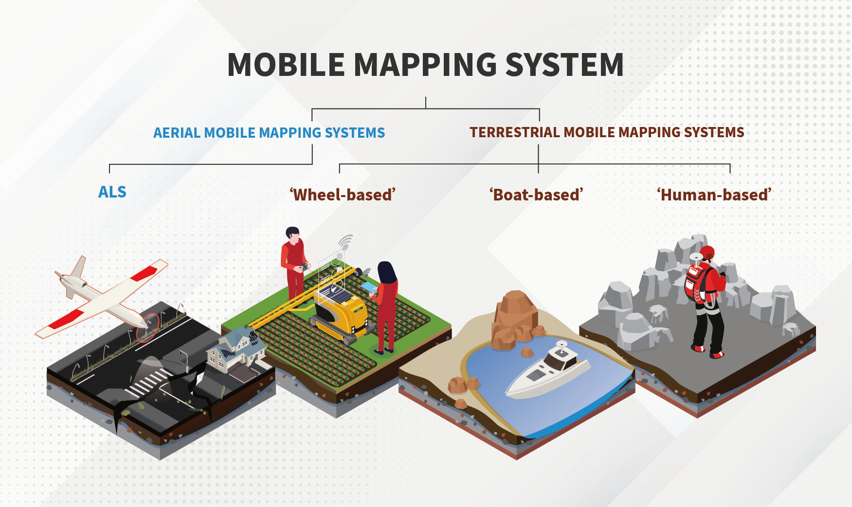
↑ the classification of MMS ↑
The development of MMS technology has benefited from the improvement and innovation of the navigation and positioning system during the past two decades.
As vital components of MMS technology, the Global Navigation Satellite System (GNSS) and the Inertial Measurement Unit (IMU) ensure the correct geo-referenced positioning for the 3D laser scanning data.
GNSS receivers provide positioning and time information from satellite signals to determine position. IMU has gained significant popularity as a low-cost way to measure motion. The IMU measures linear acceleration (three-axis accelerometer) and spin rates (three-axis gyroscope), which can be numerically integrated to provide three-dimensional position and orientation. Combined with position data, the IMU allows the transformation of point data in the system's local frame into a ground-centric-ground-fixed coordinate system, therefore compensation from the IMU will have a direct impact on the geometric quality of all point clouds projected into a common frame.
However, due to the complexity and variety of practical application scenarios, some special scenarios or data acquisition environments cannot provide valid GNSS signals.
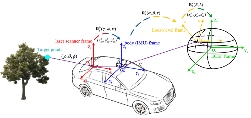
↑ Relationship of three coordinate frames↑
To improve positioning accuracy and eliminate positioning errors in GNSS-denied environments, the developers have made significant improvements on both data-driven and model-driven techniques. The former is to repair point cloud data directly from the ground control point and use a variety of correction algorithms, while the latter is to establish a mathematical model for the MMS system to analyze error factors to complete bias calibration.
During the past decade, Simultaneous Localization and Mapping (SLAM) algorithms have been developed in robotics to generate maps while locating mobile platforms.
Absolute positioning using feature-matching and relative positioning using scan-matching are the two main strategies of SLAM technology, but the premise of improving accuracy requires closed-loop measurements introduced by control points.
The current SLAM algorithm performs better in indoor applications because of the regular and repetitive environment features. In outdoor applications, due to the complexity and irregularity of the environment, abrupt shifts or missing scans often occur, which are great challenges for computation payload and algorithm design.
However, the combined application of the GNSS/IMU system and SLAM technique will provide a greatly improved solution, which can not only reduce the navigation drift in the scenarios with poor GNSS signal, but also provide absolute positioning information that the SLAM algorithm cannot provide.
While focusing on the GNSS/IMU navigation and positioning system, Tersus GNSS is also committed to providing a powerful mobile mapping system and improving a series of multi-platform solutions for drones, vehicles, backpacks, etc.

About Tersus GNSS Inc.
Tersus GNSS is a leading Global Navigation Satellite System (GNSS) solution provider. Our offerings and services aim to make centimeter-precision positioning affordable for large-scale deployment.
Founded in 2014, we have been pioneers in design and development GNSS RTK products to better cater to the industry’s needs. Our portfolios cover GNSS RTK & PPK OEM boards, David GNSS Receiver, Oscar GNSS Receiver, MatrixRTK [GNSS CORS Systems] and inertial navigation systems.
Designed for ease of use, our solutions support multi-GNSS and provide flexible interfaces for a variety of applications, such as UAVs, surveying, mapping, precision agriculture, lane-level navigation, construction engineering, and deformation monitoring.
Sales inquiry: sales@tersus-gnss.com
Technical support: support@tersus-gnss.com
