UAV Mate
RTK from Satellites™ without Base Station or CORS

Key Advantages at a Glance
CORS networks are expensive and limiting
Dependent on CORS - Ongoing costs, limited coverage, infrastructure dependency
CORS/NTRIP subscriptions cost hundreds to thousands per year
Coverage gaps in rural, remote, or developing regions
Accuracy degrades beyond 30–40 km from nearest CORS station
Reliant on third-party infrastructure and uptime
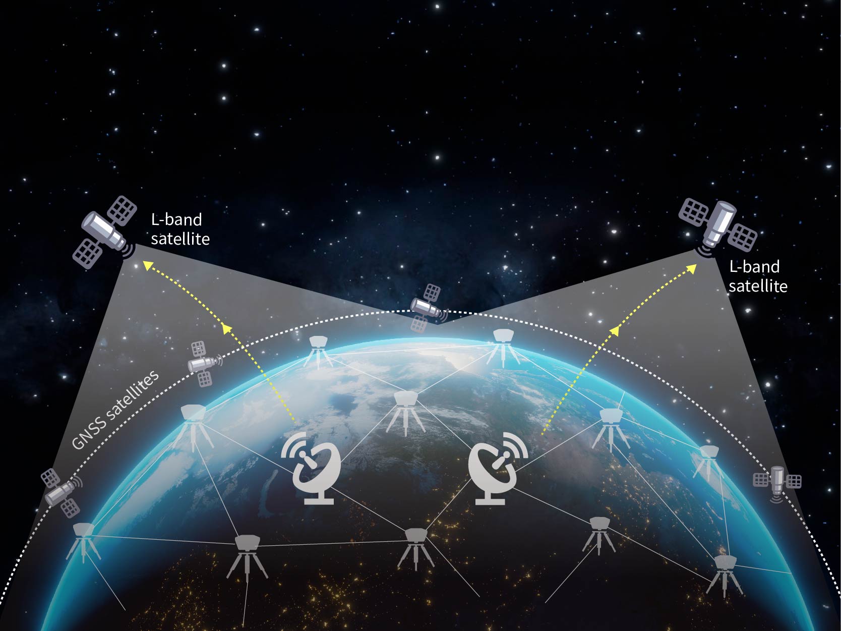
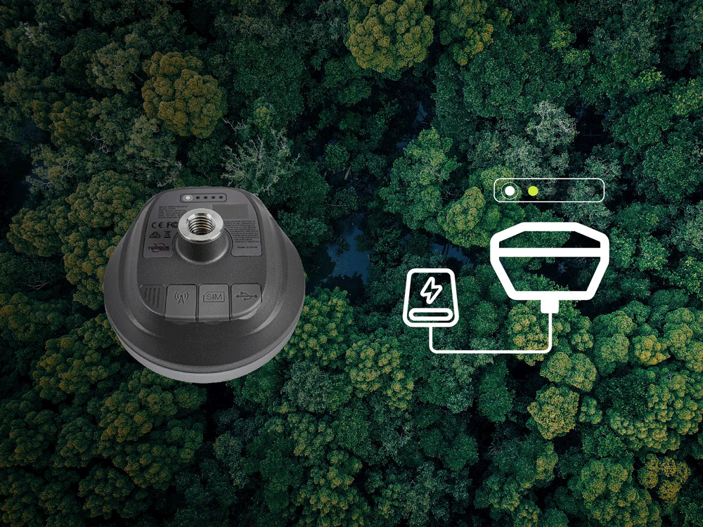
PPP replaces CORS - Satellite-based, global coverage, no infrastructure
PPP uses satellite orbit & clock corrections — no local CORS needed
Works anywhere on Earth with open sky — commercial L-Band PPP with 99% availability, dual-satellite coverage
Self-converges to 1.5 cm in ~3 minutes — no base station network required
No ongoing NTRIP or CORS subscription fees for positioning
Coordinates in ITRF2020 current epoch — transformable to any national or local datum
Broadcasts RTCM corrections to any RTK device: drones, tractors, graders, survey rovers
Professional-grade capabilities
High-Precision PPP
1.5 cm horizontal and 3 cm vertical accuracy referenced to ITRF2020. Real-time satellite corrections deliver consistent global coordinates anywhere.
PPP / RTK / PPK
Supports PPP, RTK, and PPK workflows in one compact system. UAV Mate can operate as a self-converging PPP base station, a traditional RTK base, or a rover for flexible field deployment. Whether you need real-time centimetre-level corrections or raw data for post-processing, it helps streamline UAV mapping, surveying, agriculture, and machine-control workflows without relying on fixed infrastructure.
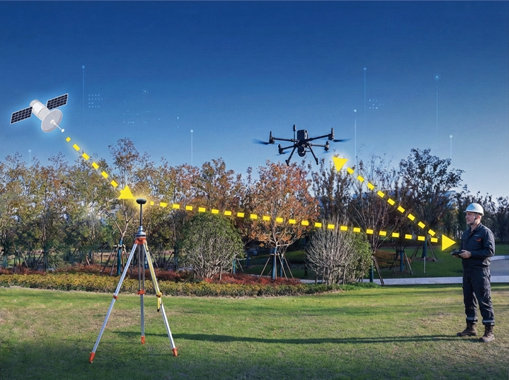
Local Correction Trasmission
Stream RTK corrections directly to your UAV controller or GNSS rover through a private Wi-Fi hotspot. UAV Mate enables local correction delivery without CORS, UHF relay setup, or cellular network dependency, making it ideal for remote mapping missions, construction sites, farms, mines, and other off-grid environments where conventional correction services are unavailable or unreliable.

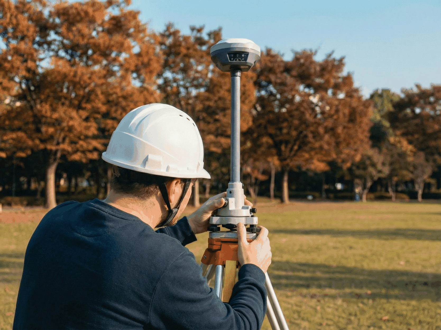
GCP Collection
Use UAV Mate as a high-precision rover for ground control point collection and checkpoint measurement. With PPP-based positioning, field teams can collect accurate control data without setting up a local base station or depending on nearby CORS coverage. This helps reduce preparation time and supports repeatable, well-georeferenced UAV mapping results across remote or infrastructure-limited project sites.
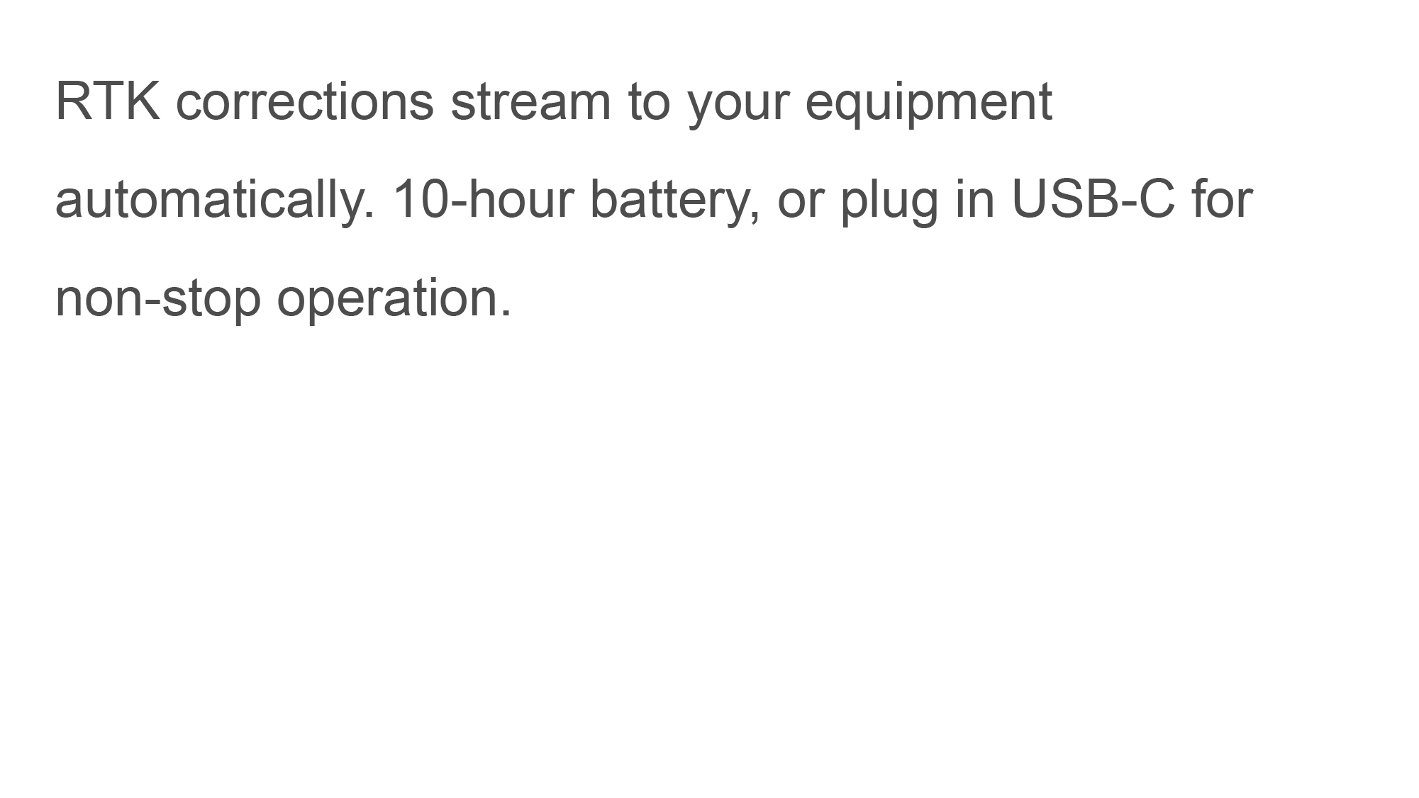
Long Battery Life
Work confidently through long field missions with up to 10 hours of operation on a single charge. The built-in 7000 mAh battery supports extended UAV mapping, GCP collection, surveying, and machine-control tasks, while 15W fast charging and USB-C external power compatibility provide flexible options for full-day or continuous field deployment.

Integrated Connectivity
Built-in UHF radio, 4G module, Wi-Fi, Bluetooth, and USB-C connectivity give UAV Mate the flexibility to support multiple correction workflows. It can deliver RTK corrections locally, connect to NTRIP services when available, or support remote PPP-based operation in the field. This integrated communication design simplifies deployment across drones, agricultural machinery, and construction equipment.
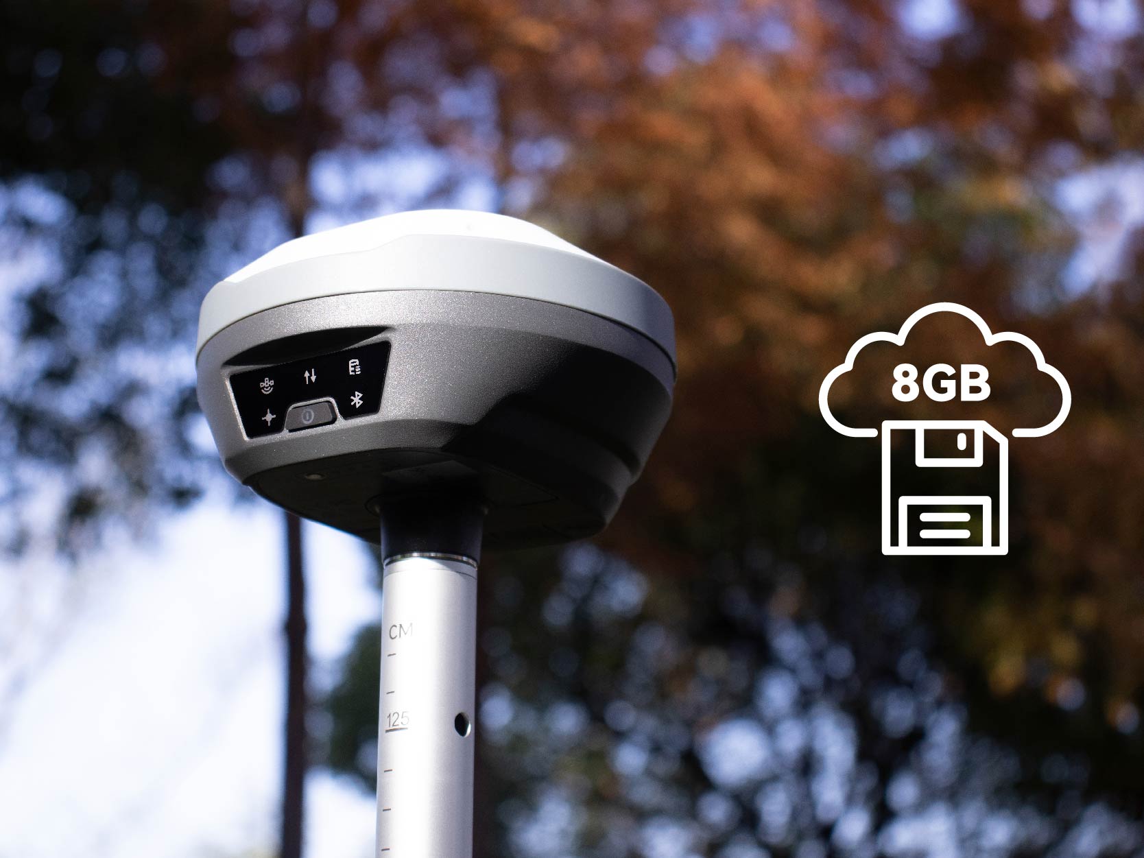
Onboard Data Logging
Internal 8GB storage records raw GNSS observations in RINEX format for PPK post-processing, quality control, and project documentation. Field teams can preserve mission data for later analysis, improve traceability, and support workflows where real-time correction links are limited, interrupted, or supplemented by post-processed positioning results.

Rugged & Weatherproof
IP68 dust and water resistance. Survives 2-meter concrete drop. Operates from −40 °C to +70 °C.
One device. Every mission.
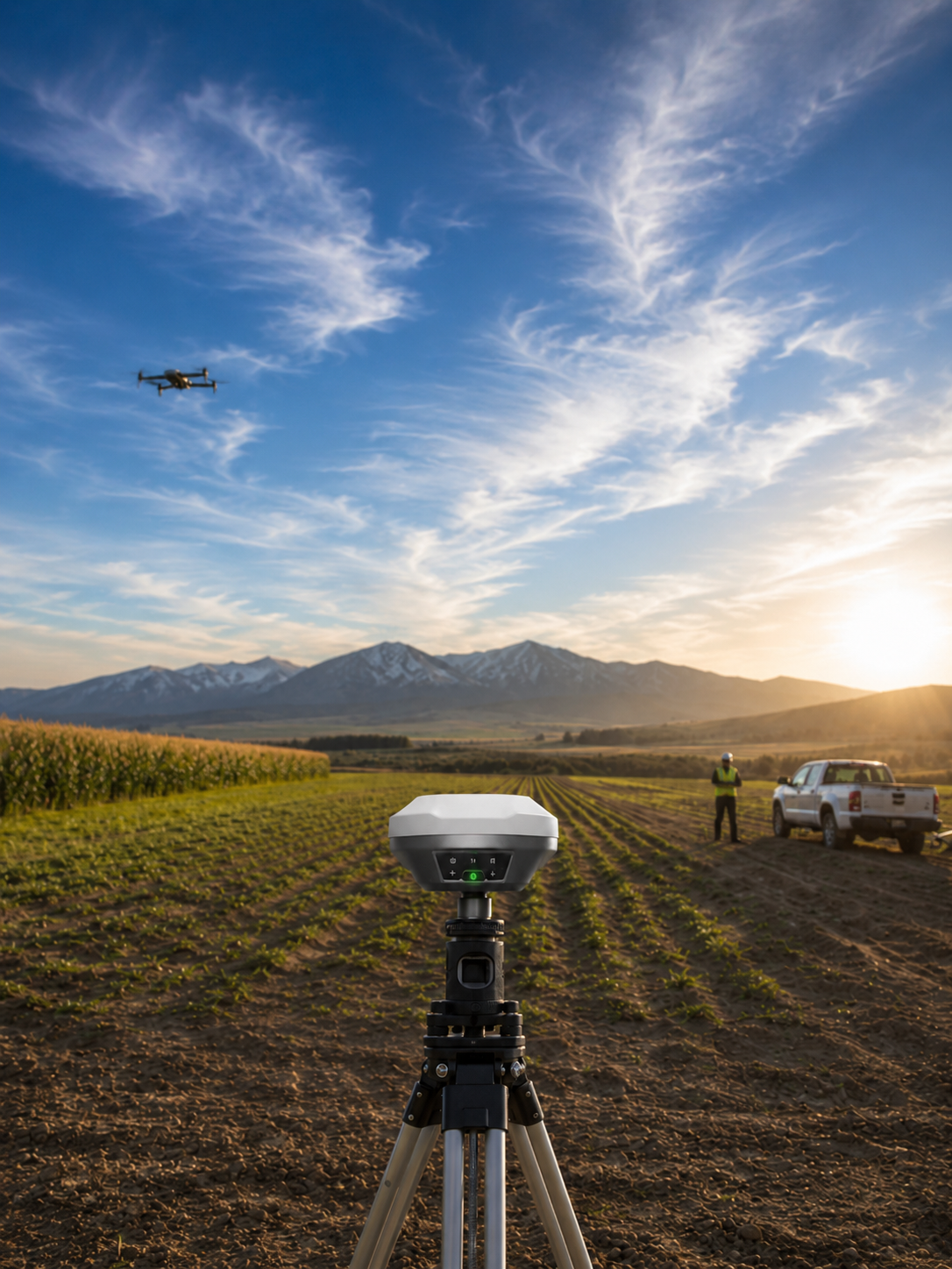
UAV & Drone Mapping
Capture high-precision aerial data for orthomosaic maps, 3D models, terrain analysis, and progress monitoring. UAV Mate delivers centimetre-accurate RTK corrections directly from satellite, enabling reliable drone mapping in remote areas without CORS coverage or cellular networks — so every flight produces survey-grade results with confidence.
Mining & Stockpiles
Fly volumetric surveys over mine sites where CORS coverage doesn't exist. UAV Mate delivers centimetre-accurate corrections from satellite — calculate stockpile volumes with confidence, even at the most remote pit.
Agriculture & Land Management
Map drainage patterns, plan variable-rate seeding, and verify land boundaries across vast farms. No cellular network needed — UAV Mate works off-grid in Kazakhstan, Australia, Brazil, or anywhere your fields are.
Construction & Infrastructure
Monitor earthworks, guide machine control systems, and survey road corridors. UAV Mate provides RTK corrections for drones, graders, excavators, and survey rovers — without an annual CORS subscription eating your project budget.
Three steps. Five minutes.
Getting Started
Technical Specifications
GNSS Performance
Communication
System & Electrical
Physical & Environmental
Product Resources
Frequently Asked Questions
What is L-Band PPP?
L-Band PPP (Precise Point Positioning) is a satellite-based correction technology that delivers centimetre-level positioning without any ground infrastructure. Geostationary satellites continuously broadcast precise orbit and clock correction data on the L-Band frequency (around 1.5 GHz), covering entire continents with a single beam. UAV Mate receives these signals alongside standard GNSS observations from GPS, GLONASS, Galileo, and BeiDou, then runs a PPP algorithm that converges on its true absolute coordinates — typically 1.5 cm horizontal accuracy within about 3 minutes of open-sky operation. Because the correction data comes directly from satellites rather than a terrestrial network, there is no baseline limit, no NTRIP subscription, no internet dependency, and no coverage gap. The result is a self-contained base station that knows exactly where it is on the planet, and can broadcast that knowledge as standard RTCM 3.x corrections to any nearby rover. Traditional RTK requires someone to have already surveyed the base station location or depend on an active CORS network — PPP eliminates both requirements entirely.
What are RTK corrections?
RTK (Real-Time Kinematic) is the technique that turns a standard GNSS receiver from metre-level to centimetre-level accuracy. Here is how it works: a base station sitting at a known location receives the same satellite signals as your rover (drone, tractor, survey receiver). Because the base station knows its own coordinates precisely, it can calculate the errors present in the satellite signals at that moment — atmospheric delays, orbit errors, clock drift — and package them into a compact correction message (RTCM 3.x format). This correction is transmitted to the rover via radio link, 4G cellular, or NTRIP internet stream. The rover applies the correction in real time, cancelling out most of the errors and achieving 1–2 cm accuracy. The key requirement is that someone must establish the base station coordinates first. Traditionally this means surveying the point manually, subscribing to a CORS network, or accepting only relative accuracy. UAV Mate solves this by using PPP to autonomously determine its own absolute coordinates, then generating RTK corrections automatically — giving you the precision of RTK with the global reach of PPP.
What is relative accuracy?
Relative accuracy means that all points within a single survey session are precisely positioned relative to each other, but the entire dataset may be offset from its true location on Earth by an unknown amount. This happens whenever you set up a conventional base station and simply let it average its position or assign arbitrary coordinates. Your internal measurements — distances between points, area calculations, elevation differences — will all be excellent (centimetre-level). However, the whole block of data could be sitting 1–3 metres away from where it should actually be in a global coordinate system. The practical consequences are significant: if you return next week and set up the base again, the new offset will be different, so your two datasets will not align. You cannot reliably overlay your data on government cadastral maps, satellite imagery, or other teams' surveys. Merging datasets from different days requires manual post-processing with control points. For many drone mapping and agricultural guidance applications, this hidden shift creates real problems — repeated passes do not line up, and field boundaries drift between sessions.
What is absolute accuracy?
Absolute accuracy means every point in your survey is positioned correctly within a global reference frame — such as ITRF2020 or WGS84 — reflecting its true location on the surface of the Earth to within a stated tolerance (1.5 cm horizontal in the case of UAV Mate). This is fundamentally different from relative accuracy because there is no unknown offset. When you survey on Monday and return on Friday, both datasets share the same coordinate system and align perfectly without any adjustment. Your data matches government geodetic control points, integrates seamlessly with cadastral records, overlays accurately on satellite imagery, and merges cleanly with surveys from other teams using any properly georeferenced equipment. UAV Mate achieves absolute accuracy through PPP: it receives satellite orbit and clock corrections on the L-Band, computes its own global coordinates autonomously, and then broadcasts RTK corrections anchored to those coordinates. No manual coordinate entry, no CORS dependency, no post-processing shifts — just consistent, repeatable, globally referenced centimetre positioning every time you power on.
What does this thing actually do?
It sits on the ground and broadcasts RTK corrections to any GNSS-RTK device — drones, agricultural auto-steer systems, construction machine control, or survey rovers. Accurate to 2 centimetres. That means your survey maps, precision ag operations, and machine-guided earthworks come out precise without any extra work.
Do I need to set up ground control points?
You can still use GCPs for checkpoints, but UAV Mate dramatically reduces how many you need. Many users skip them entirely for routine jobs. That alone can save hours per mission.
Is it hard to set up?
Nope. Put it on the ground with open sky, press the power button, wait about five minutes. That’s it. No apps to configure, no coordinates to type in. It figures everything out on its own.
What devices does it work with?
Any device that accepts RTCM 3.x corrections: DJI drones (Matrice, Phantom 4 RTK, Mavic 3E), ArduPilot/PX4 builds, agricultural auto-steer (John Deere, CNH, CLAAS via ISOBUS), construction machine control systems, and survey rovers from Emlid, Tersus, and others.
What if I’m in a remote area with no internet?
That’s actually where UAV Mate shines. It has a built-in radio link that works without any internet at all. You can work in the middle of nowhere — mountains, farmland, desert — and still get centimetre accuracy. Just ensure open sky so UAV Mate can receive L-Band satellite signals.
How long does the battery last?
All day. One charge gets you through a full day of fieldwork. You can also plug in a USB-C power bank if you need longer.
Can I carry it in my backpack?
Yes — it’s compact and doesn’t need a tripod. Way more portable than the big base stations you’ve probably seen in surveying courses.
Why not just use a CORS network?
CORS subscriptions cost $500–2,000 a year, don’t work everywhere (especially rural areas), and you’re relying on someone else’s network staying online. UAV Mate gets the same accuracy from satellites directly, so none of those problems apply.
What happens if it rains?
Keep working. It’s IP68 rated — fully waterproof and dust-proof. Rain, mud, puddles, no problem.
Ready to Build a Faster Field Workflow with UAV Mate?
Talk to our team for pricing, demo support, technical evaluation, or distributor cooperation.