
TAP Global PPP Correction Service
TAP is a satellite-based precise point positioning service developed by Tersus GNSS, which allows users to achieve centimeter-level high-precision positioning worldwide.

TAP -- Tersus Advanced Positioning
TAP is a satellite-based precise point positioning service developed by Tersus GNSS, which allows users to achieve centimeter-level high-precision positioning worldwide. With TAP , the GNSS rover receiver will not need to work with the local RTK base station or CORS, but directly receives corrections broadcast by the satellites, such as ephemeris error, satellite clock error, etc. TAP meets the demand of centimeter-level high-precision positioning in areas without or with poor network coverage, such as oceans, deserts, mountains, high altitudes, etc.

Documents
-
Datasheet_TAP
Release Date: 2024-06-07 Version:1.2
-
Datasheet_Oscar-TAP
Release Date: 2023-11-02 Version:1.0
-
Datasheet_David30-TAP
Release Date: 2025-09-02 Version:1.3
-
Brochure_TAP
Release Date: 2024-06-07 Version:1.4
Related Products
PPP Service
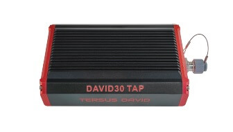
David30-TAP GNSS Receiver
PPP Service
Oscar-TAP GNSS Receiver
GNSS OEM Boards
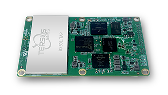
BX50L-TAP
GNSS OEM Boards
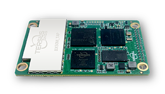
BX50M-TAP
Sign up for free demo and trial
Sales Inquiry