Tersus Releases GeoCaster Software, a Cost-effective Caster Software for NTRIP Corrections
Shanghai, Jan 10, 2019 - Tersus GNSS Inc. today released the Tersus GeoCaster, which is a Networked Transport of RTCM via Internet Protocol (NTRIP) Caster Software to expand its product line and provide users with better and more comprehensive services.

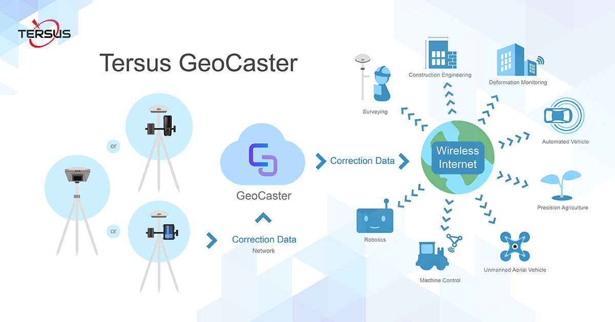
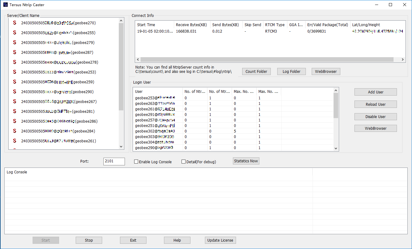
“The Tersus Networked Transport of RTCM via Internet Protocol (NTRIP) Caster Software is designed to allow GNSS correction data such as RTCM corrections to be repeated and sent to different end users via the internet,” said Xiaohua Wen, Founder&CEO of Tersus GNSS Inc. “GeoCaster has a user-friendly interface and it not only supports multiple bases online simultaneously but also supports multiple rovers for one base. Our users can have a real-time review of detailed statistics and can modify user-defined permissions manually.”
The Tersus GeoCaster supports configurable bases online simultaneously and configurable rovers for one base. GeoCaster supports Ntrip protocol and it has 7X24 hours operation.
The end users involved in various applications including surveying, construction engineering, deformation monitoring, automated vehicle, precision agriculture, Unmanned Aerial Vehicle, machine control, robotics, and etc.

It's the first release of GeoCaster 1.0. By the time of version 2.0 release, VRS or Vbase functions are ready, it can be much higher accuracy and longer baseline application. GeoCaster 2.0 is targeted at Q1 2019, stay tuned.
For more product information:
- Tersus GeoCaster, click here.
- Tersus GeoBee, click here.
About Tersus GNSS Inc.
Tersus GNSS is a leading Global Navigation Satellite System (GNSS) solution provider. Our offerings and services aim to make centimeter-precision positioning affordable for large-scale deployment.
Founded in 2014, we have been pioneers in design and development GNSS RTK products to better cater to the industry’s needs. Our portfolios cover GNSS RTK & PPK OEM boards, David GNSS Receiver, Oscar GNSS Receiver, MatrixRTK [GNSS CORS Systems] and inertial navigation systems.
Designed for ease of use, our solutions support multi-GNSS and provide flexible interfaces for a variety of applications, such as UAVs, surveying, mapping, precision agriculture, lane-level navigation, construction engineering, and deformation monitoring.
Sales inquiry: sales@tersus-gnss.com
Technical support: support@tersus-gnss.com
