Nuwa V2.3.2.2 New Release
Nuwa is a survey application running on Android developed by Tersus, which is interactive and friendly, easy to operate, and has rich and powerful functions that can help surveyors complete measurement more efficiently and accurately.
Recently, Nuwa V2.3.2.2 has been released. Let’s see what are the highlights of the new version.
● Vector map import and stake
In the Import module, when the file format is selected as DXF, KML/KMZ or LandXML, it allows to select type as vector map for import. After importing, select the imported vector map in the survey or stakeout interface, and the vector drawings will be displayed correctly, completely and quickly. The display of the vector map will be more intuitive by overlaying the display of online maps such as Google Maps and OSM Maps. Click directly on a point or line on the vector map, to jump to stake the selected point or line.
● Digital Surface Stakeout
In the Surface Stakeout module, simply import the 3dface entities in the DXF files or the surfaces data in the LandXML files, and Nuwa will read and store the triangle network. Or select points from point database to form the Delaunay TIN manually. Then enter surface offsets for the imported triangle network or the created triangle network. Select the surface, the triangle network will be displayed , and if the current position is within the area, a fill or cut value will be calculated based on the interpolation elevation of the three vertices of the triangle and the entered offset.
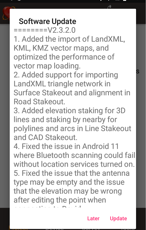
● Update Version Description
When getting a new version update, the highlights of the new version are displayed directly in the application, including important or market-focused new features, and fixes for some issues.

Go to the Tersus website to download the new version for immediate experience, or download the release notes for the full update.
About Tersus GNSS Inc.
Tersus GNSS is a leading Global Navigation Satellite System (GNSS) solution provider. Our offerings and services aim to make centimeter-precision positioning affordable for large-scale deployment.
Founded in 2014, we have been pioneers in design and development GNSS RTK products to better cater to the industry’s needs. Our portfolios cover GNSS RTK & PPK OEM boards, David GNSS Receiver, Oscar GNSS Receiver, MatrixRTK [GNSS CORS Systems] and inertial navigation systems.
Designed for ease of use, our solutions support multi-GNSS and provide flexible interfaces for a variety of applications, such as UAVs, surveying, mapping, precision agriculture, lane-level navigation, construction engineering, and deformation monitoring.
Sales inquiry: sales@tersus-gnss.com
Technical support: support@tersus-gnss.com
