- Product
- News
- Document
- Software
- Use Case
- ReIease Note
- Video
- FAQs
- Other
-
 AX4E02 Geodetic AntennaLearn More >
 -
 LUKA GNSS ReceiverLearn More >
 -
 BX50CLearn More >
 -
 TC80 ControllerLearn More >
 -
 UAV PPK SolutionLearn More >
 -
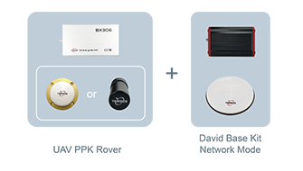 UAV PPK Solution with BaseLearn More >
 -
 BX40CLearn More >
 -
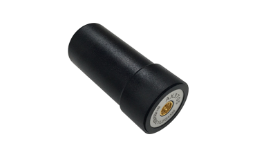
 AX4E03 Aviation AntennaLearn More >
 -
 AX4E05 Helix AntennaLearn More >
 -
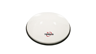
 AX4E06M 3D Mini Choke Ring AntennaLearn More >
 -
 AX4E07 High Performance Antenna for Autonomous ApplicationsLearn More >
 -
 AX3703 Aviation AntennaLearn More >
 -
 AX3705 Helix AntennaLearn More >
 -
 AX3706 3D Choke Ring AntennaLearn More >
 -
 BX316DLearn More >
 -
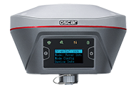 Oscar GNSS ReceiverLearn More >
 -
 BX306Learn More >
 -
 Oscar ProBase GNSS ReceiverLearn More >
 -
 TC40 ControllerLearn More >
 -
 TC50 ControllerLearn More >
 -
 TC20 ControllerLearn More >
 -
 Oscar GNSS Receiver with OptionsLearn More >
 -
 RS460H 2W Radio Wireless Data TransceiverLearn More >
 -
 RS400H3 External 28W RadioLearn More >
 -
 TP688 Industrial Modem for Ntrip CorrectionsLearn More >
 -
 RTR Rod-Tip-RollerLearn More >
 -
 David30 GNSS ReceiverLearn More >
 -
 David30-D GNSS ReceiverLearn More >
 -
 Rover Kit Network ModeLearn More >
 -
 Rover Kit with 2W RadioLearn More >
 -
 Base Kit Network ModeLearn More >
 -
 Base Kit with 2W RadioLearn More >
 -
 Base Kit with 28W RadioLearn More >
 -
 Tersus GeoBee30Learn More >
 -
 Tersus GeoBeeLearn More >
 -
 Ntrip Modem TP688Learn More >
 -
 BX306 GNSS KitLearn More >
 -
 BX306 GNSS UAV KitLearn More >
 -
 BX316D GNSS KitLearn More >
 -
 BX316D GNSS UAV KitLearn More >
 -
 AG992-ProLearn More >
 -
 MatrixRTK ReceiverLearn More >
 -
 Tersus GeoCasterLearn More >
 -
 Tersus Nuwa AppLearn More >
 -
 Tersus GNSS CenterLearn More >
 -
 Tersus PNW SoftwareLearn More >
 -
 Tersus Advanced PositioningLearn More >
 -
 Tersus Metaverse PainterLearn More >
 -
 TAS-Z1 Total StationLearn More >
 -
 TheDuck™Learn More >
 -
 AG992Learn More >
 -
 TAS-Z1 Pro Total StationLearn More >
-
 Mar 14, 2018Tersus Takes New Stride into Surveying with David GNSS ReceiverTersus is bringing surveying applications to next level with the launch of Tersus David, a GNSS Receiver in the global markets.
 -
 Feb 08, 2018Tersus Makes Debut at IGNSS in Australia and Showcases High Precision GNSS ReceiversAt the International Global Navigation Satellite Systems IGNSS 2018 conference in Sydney, Tersus made debut and introduced David, NeoRTK and MatrixRTK, etc.
 -
 Feb 02, 2018Tersus David Preview: MUST-SEE Highlights Before ShowtimeTersus David is a GNSS receiver to cater the increasing needs of cost-efficient, ease-to-use, lightweight as well as high-precision mobile survey tools.
 -
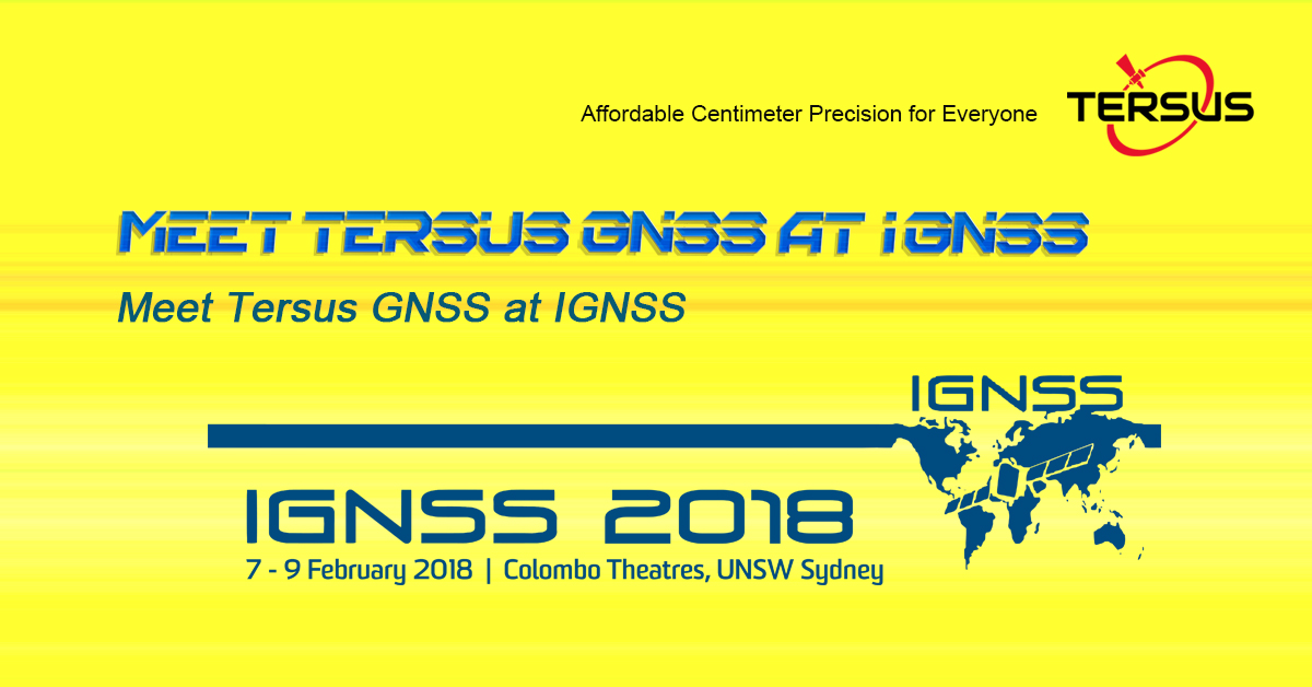
 Jan 29, 2018Meet Tersus GNSS at IGNSS 2018 in SydneyTersus is looking forward to the opportunity to take part in IGNSS 2018 and meeting you there with our latest GNSS product showcase.
 -
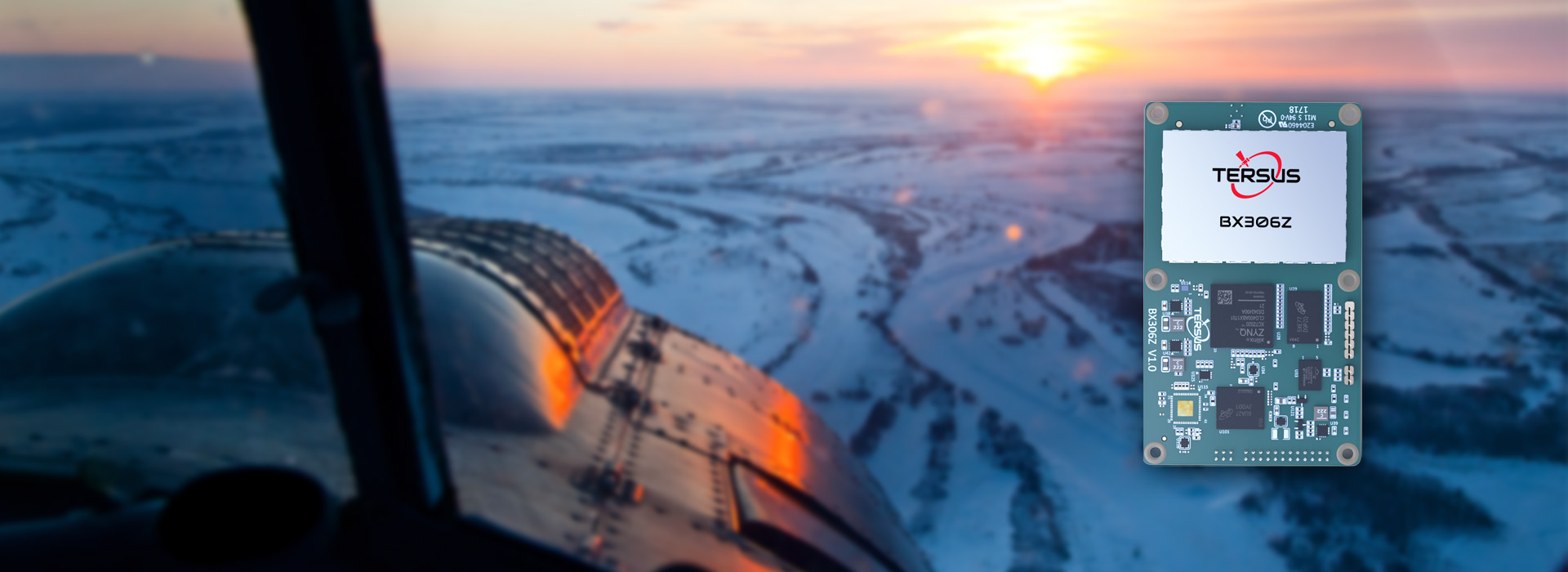 Jan 24, 2018Tersus Launches BX306Z GNSS RTK Board to Meet the Needs of OEMs and System IntegratorsTersus launched BX306Z GNSS RTK board with powerful flexibility and compatibility to meet or exceed the needs of OEMs and system integrators.
 -
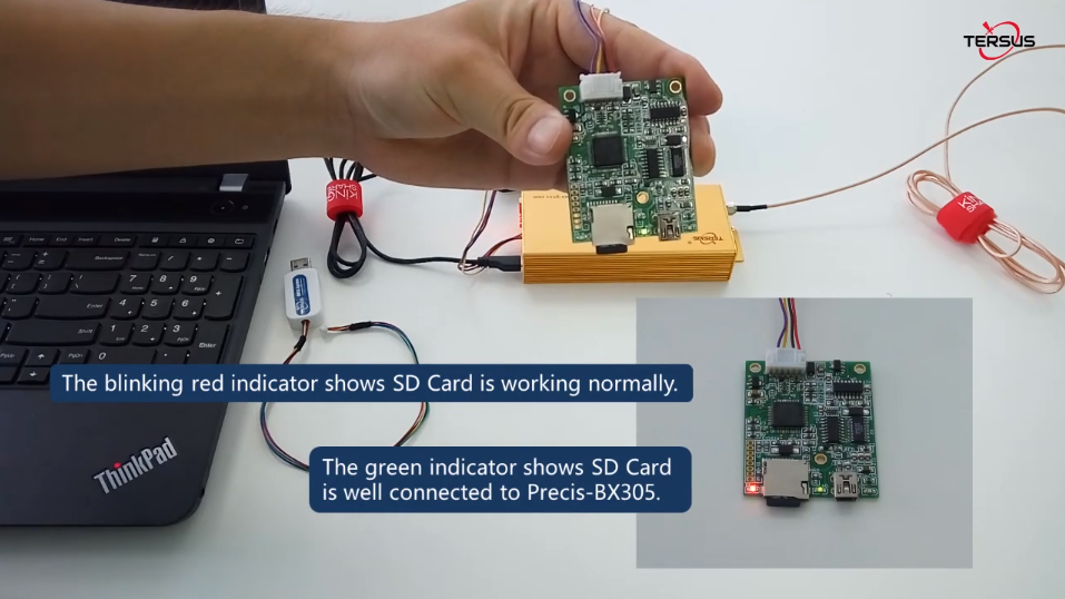
 Nov 29, 2017Announce GNSS OEM Board Firmware V1.16An upgraded version of GNSS RTK & PPK OEM board firmware is available for download. For BX316 and BX 316R, hot mount for SD card is added. Upgrade now.
 -
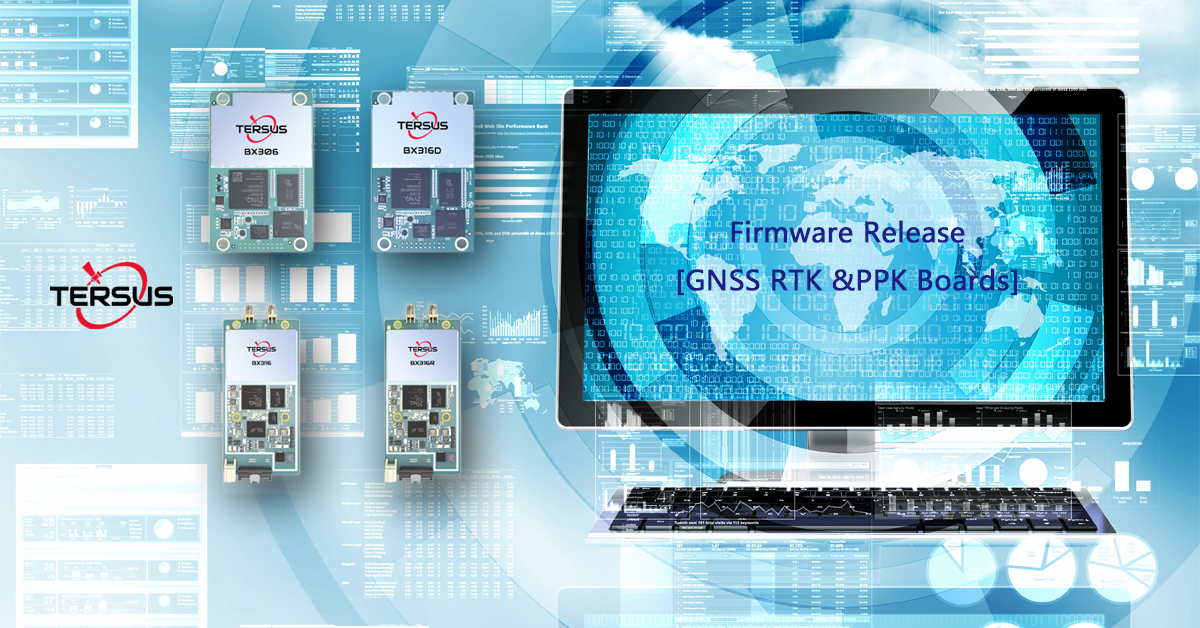 Nov 09, 2017Upgrade to GNSS OEM Board Firmware V1.15OEM boards firmware updated. All update improves RTK positioning performance and high-precision navigation in more challenging environments.
 -
 Oct 27, 2017RTKLIB SupportsRTKLIB consists of a portable program library and several APs (application programs) utilizing the library. And now it supports "Tersus" format.
 -
 Sep 26, 2017Tersus GNSS Showcases Its Innovative RTK Solutions at InterGEO 2017, BerlinTersus is launching its proprietary RTK technology and integrated solutions, the Tersus David RTK box as well as the Precis GNSS Boards & Receivers, today at InterGEO 2017.
 -
 Sep 06, 2017Tersus Announces New GNSS RTK System [NeoRTK] for Surveying at InterDrone 2017Tersus announced its latest GNSS RTK System, the NeoRTK system at InterDrone.
 -
 Sep 06, 2017Tersus Launches New Version of BX306 RTK Board at InterDrone 2017Tersus announced a major upgrade to its popular BX306 RTK board with new and improved GPS/GLONASS functionality today.
 -
 Aug 09, 2017Join Us at 2017 IASEXPO [Berlin, Germany)] [Booth #C6 A029]Join Tersus at IASEXPO (the InterAerial Solutions as part of InterGEO) in Berlin and discover the power of Precis GNSS RTK boards and GNSS-aided inertial navigation system for drone-related applications.
 -
 Jul 11, 2017Visit Us at 2017 InterGEO [Berlin, Germany)] [Booth #C4 060]Tersus is looking forward to meeting you at the InterGEO 2017 (Berlin, Germany) on September 26 to 28.
 -
 Jul 07, 2017Meet Us @ InterDrone 2017 [Las Vegas, United States] [Booth #905]Visit our booth #905 at InterDrone from September 6 to 8 at Rio, Las Vegas, United States.
 -
 May 31, 2017Interview by GIM: 5 Questions to Xiaohua Wen, CEO of Tersus GNSSThe GNSS industry is a very dynamic market full of growth opportunities, as several reports confirm. In China, Tersus GNSS is one of the ambitious companies looking to expand in the international GNSS business.
 -
 May 04, 2017Supported LiDAR USA to Achieve High Precision ApplicationKevin Dennehy, in his latest article [Hovering in High Performance UAS-based LiDAR Space] of Inside Unmanned Systems, Apr-May issue, mentioned that, “LiDAR USA has developed a lightweight LiDAR specifically for unmanned aircraft that is capable of getting
 -
 Apr 28, 2017Meet Us at 2017 China Satellite Navigation Conference2017 China Satellite Navigation Conference (CSNC) is underway. Come visit us at CSNC from May 23~25 in Shanghai. We’ll be at booth E2-3 and we’re happy to show you the latest products.
 -
 Apr 17, 2018Join Tersus at AUVSI Xponential, May 1 to 3, 2018Tersus is going to showcase new GNSS solutions for Drones at World’s Largest UAV Exhibition AUVSI Xponential 2018.
 -
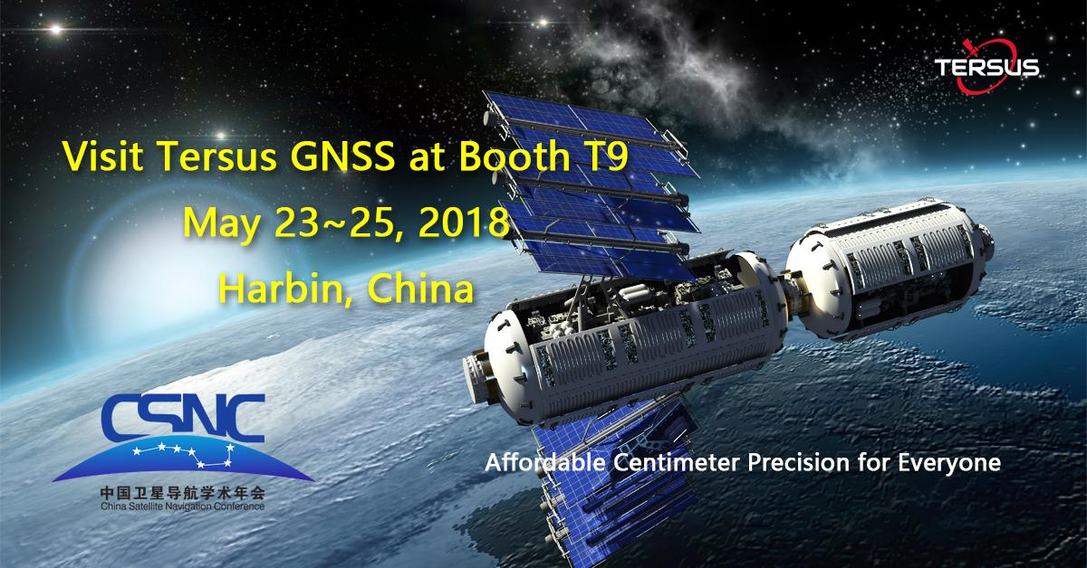 Apr 27, 2018Meet Us at 2018 China Satellite Navigation Conference [Booth T9]2018 China Satellite Navigation Conference (CSNC) is underway. Want to learn more about Tersus and our latest GNSS technology? Come visit us at CSNC from May 23~25 in Harbin. We’ll be at booth T9 and we’re happy to show you the latest products.
 -
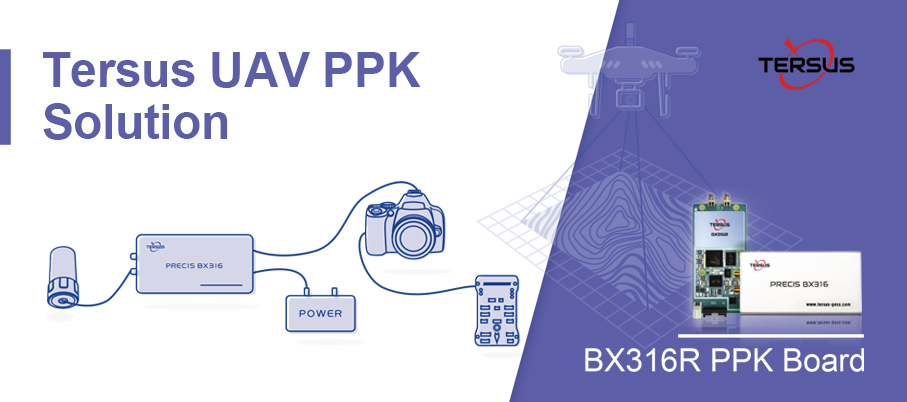 Aug 21, 2018Tersus Introduces a Practical Solution for UAV PPK ApplicationsThe Tersus UAV PPK solution includes BX316R PPK Receiver, AX3705 Helix Antenna, and Tersus GeoPix Software.
 -
 Oct 18, 2018Tersus Debuts Brand-new RTK receiver, Oscar, With Calibration-free Compensation at InterGEO 2018Tersus unveiled its proprietary RTK technology and integrated solutions, the Tersus Oscar RTK Receiver as well as the BX-series GNSS Boards & Receivers, at InterGEO 2018.
 -
 Nov 26, 2018Tersus Introduces Oscar GNSS Receiver, a brand new generation GNSS RTK systemShanghai, Nov 26, 2018 - Tersus GNSS Inc. (“Tersus”), a leading provider of centimeter-accuracy GNSS RTK solutions, is bringing surveying applications to next level with the launch of Tersus Oscar, a new generation GNSS RTK system.
 -
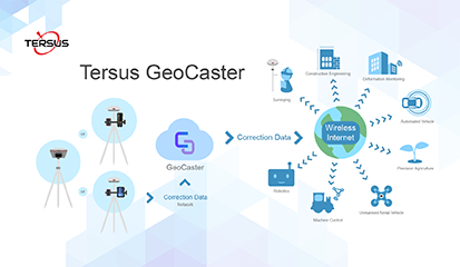 Jan 10, 2019Tersus Releases GeoCaster Software, a Cost-effective Caster Software for NTRIP CorrectionsTersus GNSS Inc. today released the Tersus GeoCaster, which is a Networked Transport of RTCM via Internet Protocol (NTRIP) Caster Software to expand its product line and provide users with better and more comprehensive services.
 -
 Feb 22, 2019Notice on GPS Week Number Rollover - 6 April 2019The GNSS receivers manufactured by Tersus GNSS Inc. can be used normally when the GPS week number rollover happens. They are not affected by this event and do not need to be upgraded.
 -
 Mar 26, 2019Tersus Launches David Plus, a Dual-antenna GNSS Receiver with HeadingTersus recently launched its new David Plus receiver, a dual-antenna GNSS receiver which offers centimeter-accurate positioning and heading.
 -
 Apr 10, 2019Tersus GNSS Showcases Its Innovative RTK Receivers at Locate19, MelbourneLocated19 has been a very inspiring event, we are thrilled to meet all the spatial industry professionals and end-users of innovativetechnology.
 -
 Sep 20, 2019Live Demonstration of Oscar Receiver with Calibration-free Compensation Caused a Great Attention at InterGEO 2019Stuttgart, September 17-19, 2019 - Tersus GNSS Inc. (“Tersus”), a leading GNSS solution provider, has showcased its proprietary RTK technology and integrated solutions, the Tersus Oscar RTK Receiver along with the BX-series GNSS Boards & Receivers and oth
 -
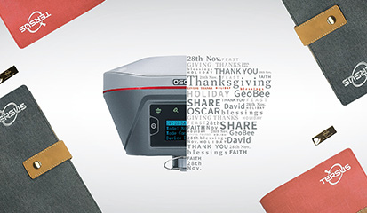 Nov 27, 2019Happy Thanksgiving!To share our genuine appreciation for you, a notebook and a USB Flash Drive will be given to you as freebies for each Oscar and David GNSS Receiver you are going to order from Thanksgiving to New Year's Day.
 -
 Feb 26, 2020Geospatial Data Must for More Efficient SocietyThe world is always developing and growing, but at different times, it has different manifestations. The phenomenon of global recession means that the production efficiency needs to be boosted. Geospatial data and technologies, like highly accurate positi
 -
 Jan 31, 2020GNSS Trends of 2020 - 4 Constellation with Triple Frequencies in the SkyTriple-frequency observations for high accuracy positioning has been studied for long time. It’s proven to improve RTK performance (fix rate, reliability, precision) greatly in some challenging scenarios for dual-frequency RTK, say very lone base line, ve
 -
 Mar 23, 2020COVID-19 (Coronavirus) Business UpdateOur teams are continuing their efforts to meet your customer requests in the coming days and weeks. Let’s stay connected to discuss your concerns, find the answers to your questions together. Let us know if you have any additional requirements.
 -
 Jun 03, 2020Tersus Introduces BX40C RTK Board, A Compact GNSS Board with Full Constellation TrackingShanghai, June 3, 2020 - Tersus GNSS Inc. (Tersus) announced the release of the BX40C RTK Board to support its series of GNSS boards and provide high accuracy, fast positioning services.
 -
 Jan 25, 2021Tersus GNSS 7th Anniversary Celebration25 January, today is the 7th anniversary of Tersus GNSS Inc.
The CEO Wen Xiaohua said that on this special day, he thanked the users and partners for their continuous love and support to Tersus. -
 Apr 20, 2021New Choice of ControllerStarting today, you got a new choice of controller! -Tersus TC50 Controller!
 -
 Apr 30, 2021Tersus GNSS & Spatial Technologies Announce Strategic PartnershipTersus GNSS is thrilled to announce a new global strategic partnership with Spatial Technologies, combining Tersus's industry leading GNSS RTK products and innovative solutions with Spatial Technologies's effective enterprise delivery and reliable technol
 -
 Aug 27, 2021185 Oscar GNSS receivers- Tersus GNSS wins the largest order in Nigeria!Tersus GNSS wins the largest order of 185 Oscar GNSS receivers in Nigeria and it is officially endorsed by NIS (Nigeria Institute of Surveyors). Started in 1934, NIS is the oldest organized bodies in Nigeria as well as the umbrella professional organizati
 -
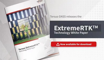 May 10, 2022Tersus GNSS releases the ExtremeRTKTM Technology White PaperTersus GNSS released its ExtremeRTKTM Technology White Paper today, which demonstrates how it delivers excellent performance in all manner of surveying scenarios and how impressive the compensated results are when performing tilt survey--even t
 -
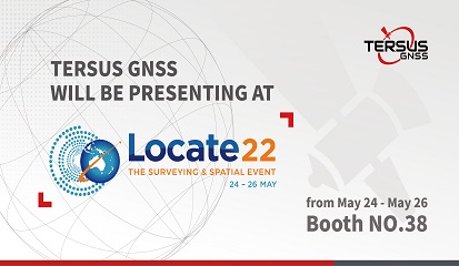 May 26, 2022Tersus GNSS Participated in Locate Conference 2022On May 24-26, Locate Conference 2022 was hosted in Canberra, Australia. Tersus GNSS showcased a variety of knock-out products and services such as Oscar GNSS Receiver, David30, BX40C OEM GNSS Board, and the satellite-based precise point positioning servic
 -
 Jul 26, 2022Nuwa V2.3.2.2 New ReleaseRecently, Nuwa V2.3.2.0 has been released. Let’s see what are the highlights of the new version.
 -
 Aug 26, 2022New Dealer Announcement: G360G360 is a firm team with strong technical background. Donald Biggs, who has worked in the surveying and engineering sectors for over 20 years, established the company in 2011. With practical experiences and professional hands-on training services, G360 ha
 -
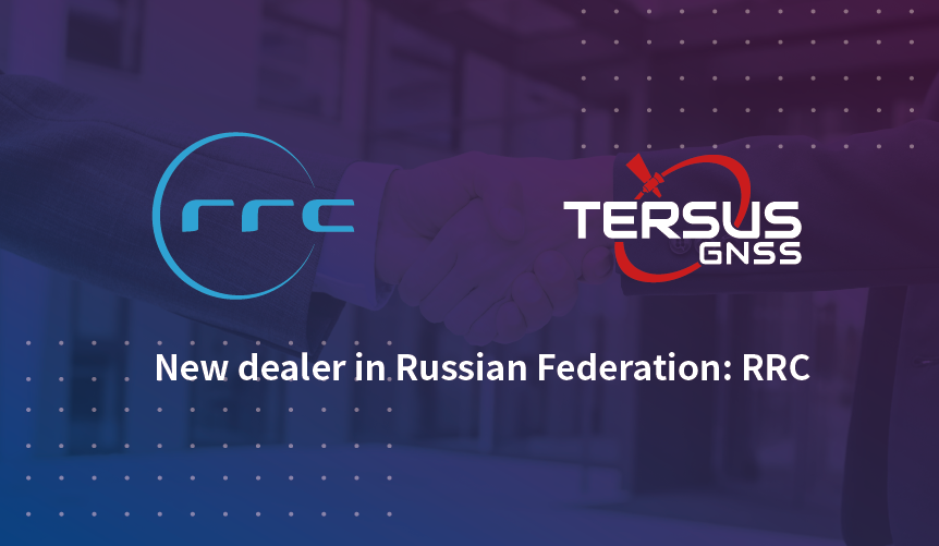 Aug 30, 2022New dealer Announcement in Russian Federation: RRCRRC is a professional distributor based in Moscow and St.Petersburg. It was founded in 1992 and is currently one of the largest distributors in Russia. They supply equipment in the field not limited to data collection and automatic identification, data tr
 -
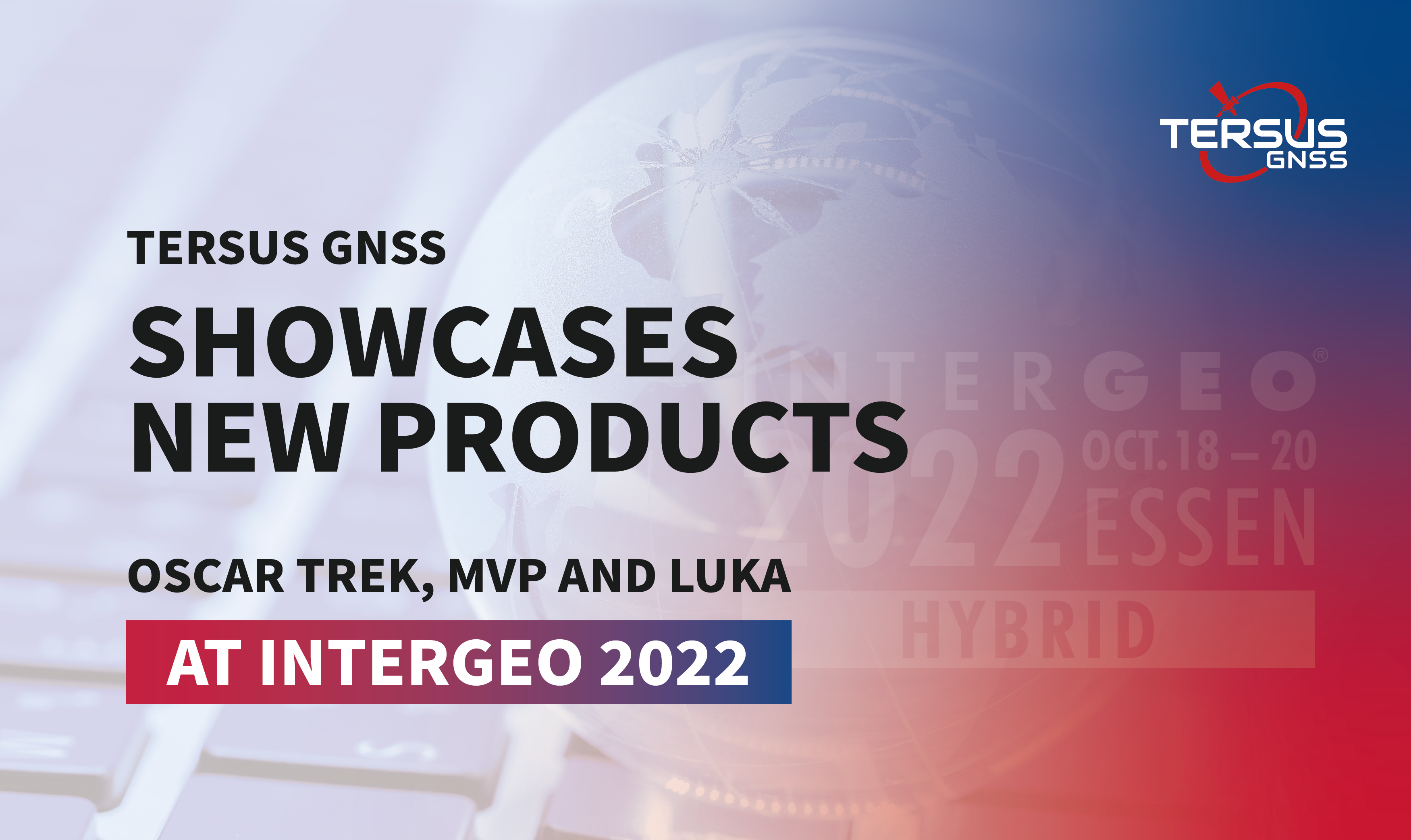 Oct 20, 2022Tersus GNSS Showcases New Products - Oscar Trek, MVP and LUKA at InterGEO 2022InterGEO 2022 was held in Essen, Germany, on October 18-20. As the largest conference trade fair of geodesy, GEO information and land management, InterGEO connects experts from all over the world to discuss and exchange views on cutting-edge GIS & GNSS te
 -
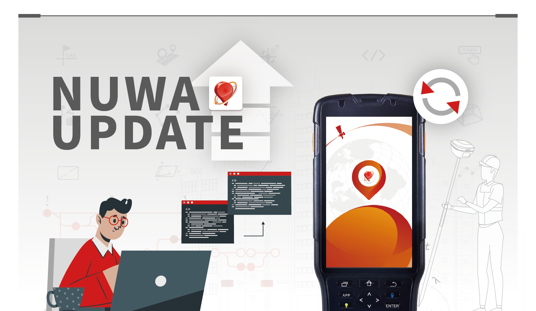
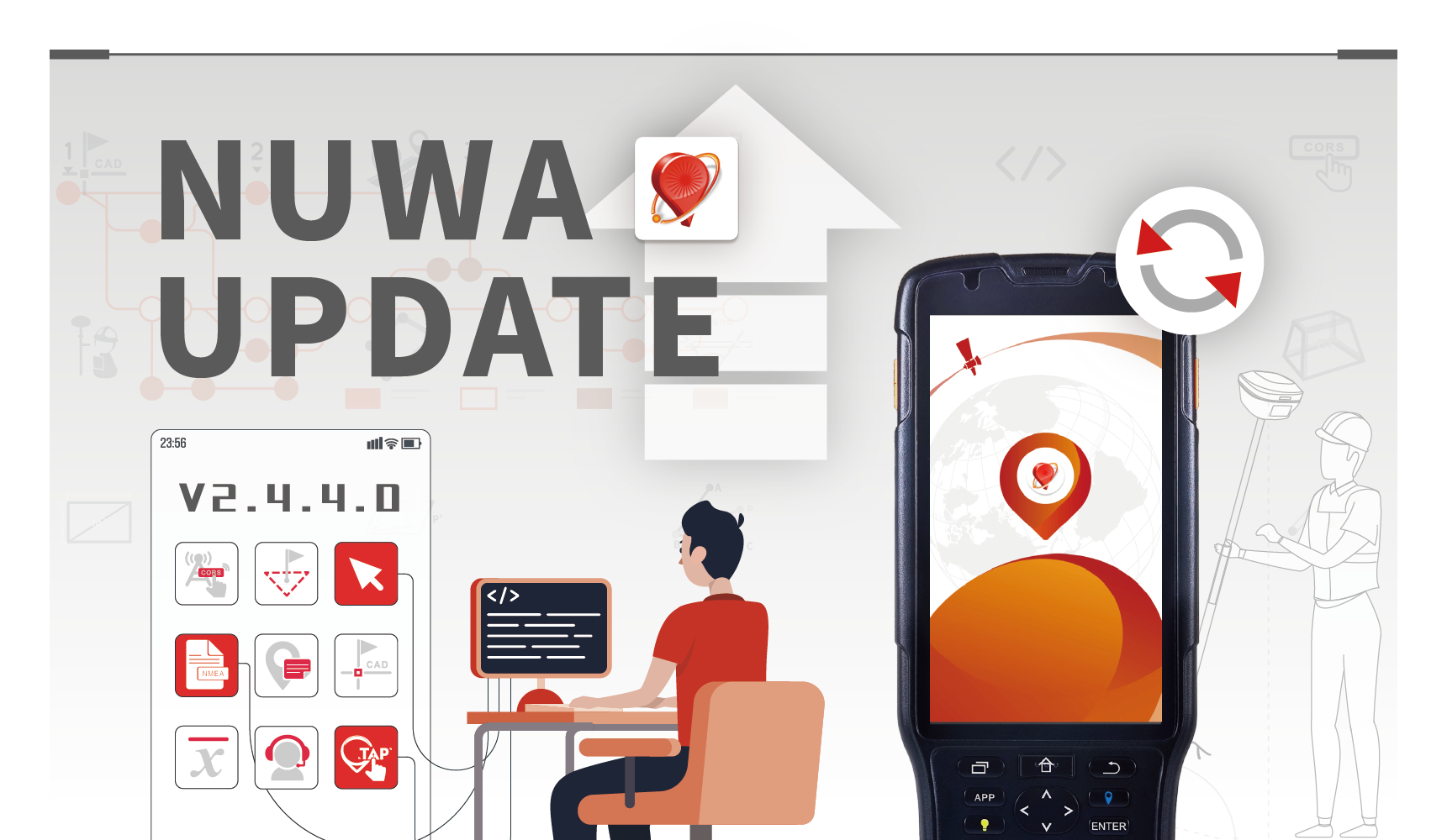 Mar 14, 2023Discover what's new features in Nuwa V2.4.4.0Recently, Nuwa V2.4.4.0 has been released. Let’s see what are the highlights of the new version.
 -
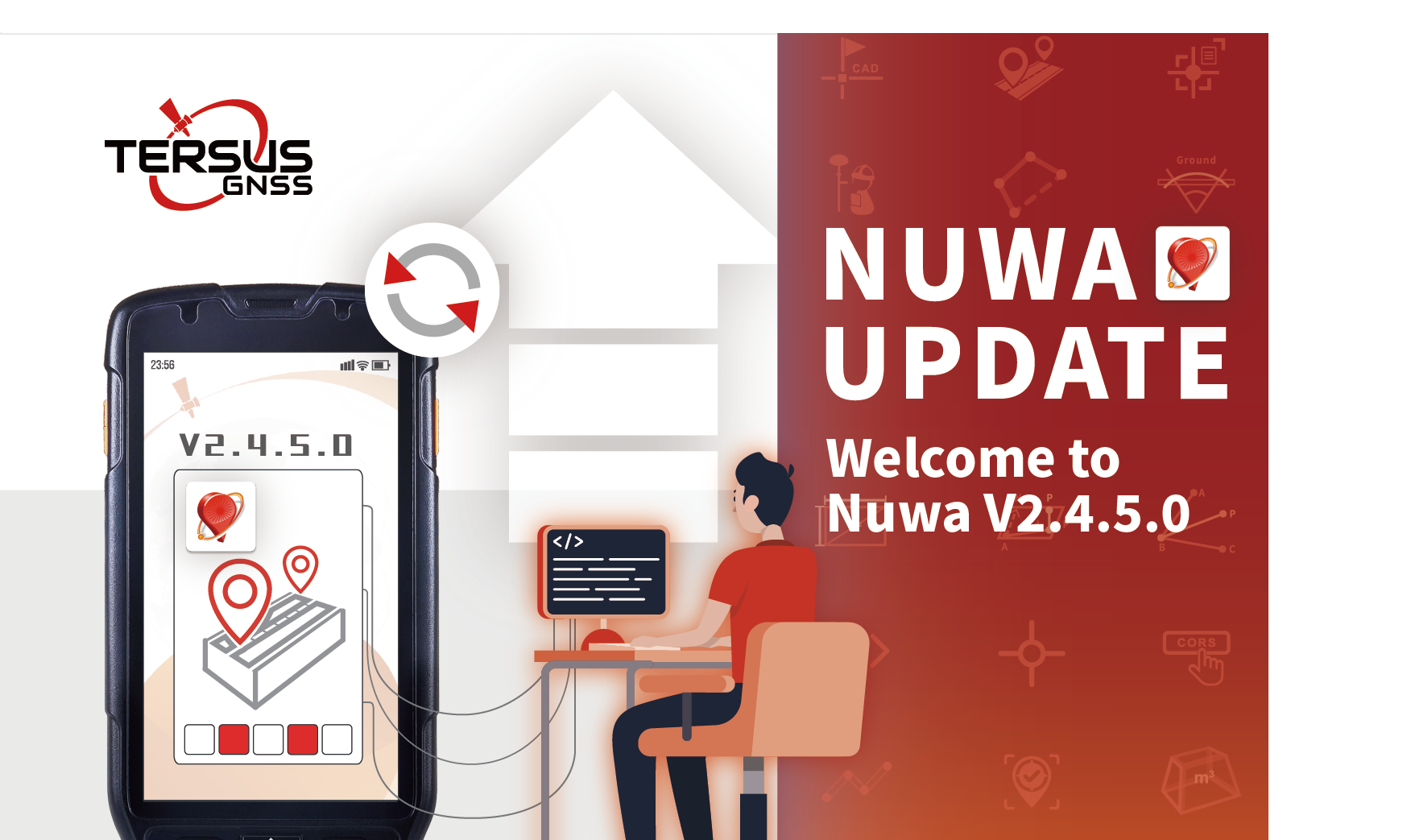 Jul 04, 2023Warm Welcome to Our New Nuwa V2.4.5.0Tersus GNSS Inc (“Tersus”) is pleasant to announce to the public that we have already released Nuwa V2.4.5.0 for GNSS receiver recently.

Yes! Tersus PPK solution is platform independent, which does not just mean that it can go from your fixed wing UAV to your Multi-rotor but also means that it operates independently of your flight controller. In fact, there is no connection between the Tersus system and your flight controller, unless you are using your flight controller to trigger event mark in Tersus system or use Tersus system for navigation purpose. So whether you are using an APM, Pixhawk, NAZA, WOOKONG, MICROPILOT, Mikrokopter, Microdrone, or any other flight controller, Tersus PPK solution will still work!
Oscar combines IMU data and GNSS RTK results to real-time calculate the three-dimensional attitude of Oscar, thereby deduce Oscar's tilt angle.
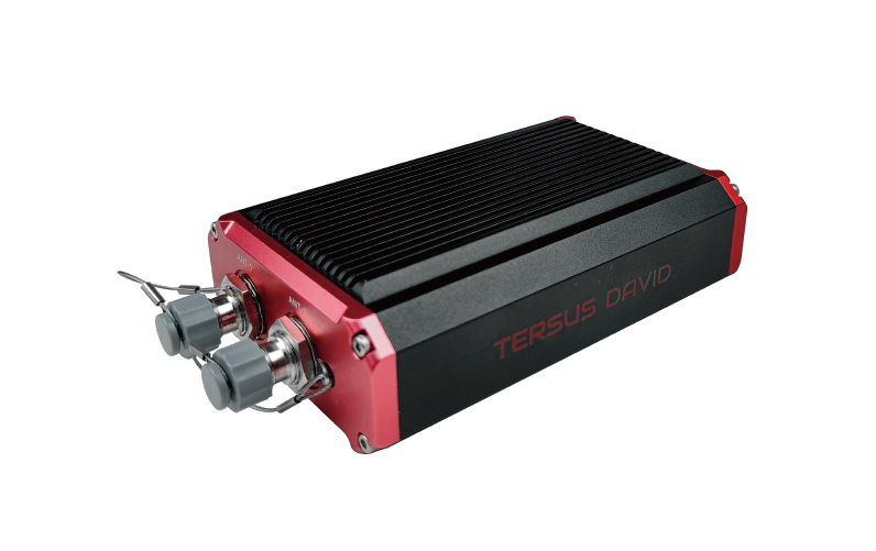
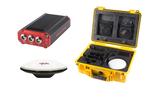
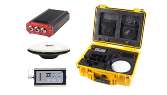
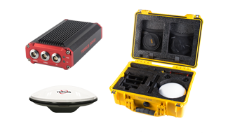
The Tersus David is a cost-efficient, palm-sized GNSS receiver designed for surveying UAVs, AGVs, and agricultural applications. Working with an external GNSS antenna, the free Tersus Survey App and post-processing software, the David GNSS receiver is a low-cost solution for all survey applications, including real-time RTK positioning and data collection for PPK.
For details, please visit: https://www.tersus-gnss.com/product/david-receiver
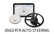
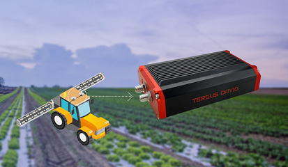
We have AG960 hydraulic drive autosteer system, AG961 motor drive autosteer system, AG963 base station kit for AG960/AG961 autosteer systems, AG980 hydraulic drive autosteer system, AG982 GNSS guidance system and AG983 base station kit for AG980/AG982 autosteer systems.
American Standard Code for Information Interchange |
Using an external antenna together with the free Tersus Survey App and post-processing software, the David GNSS receiver provides a low-cost solution for all survey applications, including real-time RTK positioning and data collection for PPK.
There are 7 different kits for Tersus David.
●David GNSS Receiver Rover Kit Mobile Mode
●David GNSS Receiver Rover Kit with 1W Radio Station
●David GNSS Receiver Rover Kit with 2W Radio Station
●David GNSS Receiver Base Kit Mobile Mode
●David GNSS Receiver Base Kit with 1W Radio Station
●David GNSS Receiver Base Kit with 2W Radio Station
●David GNSS Receiver Base Kit with 35W Radio Station
The AG960 hydraulic drive autosteer system is developed on Android platform. We have developed by C or C++ programs. You can use USB to change or update the program of panel computer (monitor). There is an interface of USB on the back of the panel computer (monitor). There is a reserved joint on the wire to use change or update the program of navigation driving box and differential reference station (you maybe use CORS or SBAS).

Compact Measurement Record |
Tersus David GNSS receiver is currently only compatible with Android smart devices.
The AG960 hydraulic drive autosteer system can be installed in corn combine harvester (hydraulic steering system). The hydraulic steering system of harvester is controlled by the valve of the AG960.
Direct Current |
Tersus David GNSS receiver can be seamless integrated with any Android smartphones. The Tersus Survey App is available for free.
The panel computer can be operating by touchscreen. It can be used for system set-up, equipment calibration, working information illustration and so on. There is a full processor in autopilot (controller).
Electro Static Discharge |
Generally speaking, there are several main classes of applications that can be used with Tersus David GNSS receivers to attain high-precision positioning details.
●Rover + CORS
●Base + Rover + Radio
●Base + Rover + Tersus NTRIP Caster
●Raw Measurements Collection
The satellite positioning signal is received by the antenna that installed on the top of the driving cap of the vehicle and differential reference station. The GNSS antenna is connected to the "GNSS antenna" port of the front panel of autopilot (controller) through a 3m RF cable. The radio receiving antenna is connected to the "radio antenna" port of the front panel of autopilot (controller) through a 3m RF cable.
Each end of the data harness (white end harness, you can find it in the user manual) is respectively connected to the autopilot (controller) and the panel computer.
One end of the drive harness (black end harness, you can find it in the user manual) is connected to the autopilot (controller). The other end is divided into three lines each of which is respectively connected to vehicle battery, electromagnetic hydraulic valve and steering measuring mechanism.
Earth Center Earth Fixed |
Global Navigation Satellite System |
Global Navigation Satellite System |
Yes. The NeoRTK supports 3G, including TD-SCDMA, WCDMA, EDGE, GPRS and GSM.
Global Positioning System |
Intermediate Frequency |
Inertial Measurement Unit |
Input/output |
Light Emitting Diode |
Low Noise Amplifier |
Micro Processing Unit |
The Tersus-Survey is RTK survey software for NeoRTK. It is capable of configuring base and rover stations, setting up stake points, stake line, detail survey, intersection, mapping survey and handling calculation and conversion for distance, angle and area with COGO.
National Marine Electronics Association |
Personal Computer |
The T17M is a GNSS controller, which can work together with NeoRTK GNSS receiver. It is equipped with MicroSurvey-FieldGenius software.
Pulse Per Second |
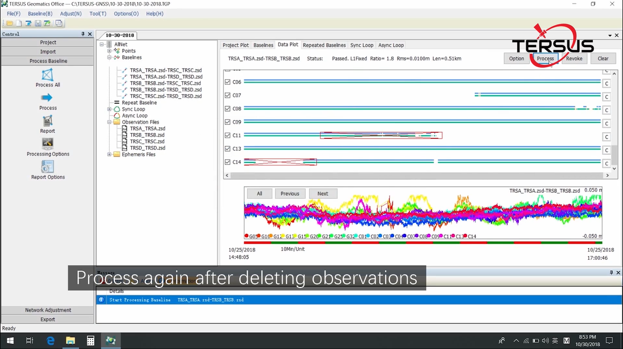
Tersus Geomatics Office is integrated office software to manage and process data for NeoRTK. It is laid out with visualized toolbars and logical icons to easily handle GNSS data processing, baseline processing and network adjustment. It is the software to import, transfer and analyze data.
Radio Frequency |
The Tersus GNSS OEM boards support RTCM 2.x/3.x/CMR/CMR+. Other communicated differential messages include correction message, correction data and differential data.
T17M works with Windows Mobile operating system.
Receiver Independent Exchange format |
In open sky environment, the initialization time for different first fixed solutions is listed as below.
●Cold start:
- Single point positioning <40 seconds
- RTK positioning<10 seconds
●Warm start:
- Single point positioning <20 seconds
- RTK positioning<10 seconds
Root Mean Squares |
There is no extra configuration necessary for receiving different RTCM messages. The Tersus BX GNSS OEM boards can automatically recognize RTCM2.X or 3.X. There is no significant difference between the versions.
CORS is for Continuously Operating Reference Stations. Tersus offers MatrixRTK, a GNSS RTK system for CORS station. With centimeter-accurate RTK board inside, MatrixRTK provides accurate and stable signal reception. Working with choke ring antenna, it can improve the capability of anti-jamming and output high-qualify RTK correction, which is ideal for establishing CORS system and monitoring system.
In theory, there are two inputs to a rover, the satellites signals from the antenna and corrections from the base. So if the rover can’t get fixed solution, please check the following:
●Does the antenna have good view of sky and is the communications connectivity reliable?
●Is the power to the antenna is OK?
●Have the RTK corrections from the base been transmitted successfully?
●The corrections datalink is OK.
●The baud rate and the receive type of the rover’s port are correct.
Real-Time Kinematic |
The possible reasons are:
●The receiver’s baud rate is not the same as the computer’s port.
●The USB adapter driver has not installed correctly.
●The GND signal of the adapter is not reliably connected to the GND of the receiver.
Radio Technical Commission for Maritime Services |
●The driver for the USB adapter is not installed successfully.
●The receiver’s baud rate is not the same as the computer's port.
●The receiver port’s Tx/Rx type is not correct.
●The cable connection is not reliable.
The BX receiver has a serial port, so in theory, any serial tool can be used to communicate with it, for example, Hyper-terminal, UarTerm or SSCOM32. It is recommended that the Tersus GNSS Centre, a graphic serial tool, is used to communicate with BX receivers.
Sub-Miniature-A interface |
The Tersus RINEX Converter supports raw measurement data and RTCM data. This data can be converted to RINEX 2.10 or RINEX 3.02 by using the Tersus RINEX Converter.
Time to First Fix |
The BT120 Bluetooth module cannot pair with an iPhone. It can only pair with Android smart phones.
Transistor-Transistor Logic level |
●The Bluetooth module is not powered correctly. It may be necessary to power cycle the BX receiver.
●The Bluetooth in a smartphone can’t be paired successfully with the Bluetooth module. The module can only communicate with an Android system.
●The baud rate of the Bluetooth is 115200, so ensure the receiver’s serial port has also been configured to 115200 baud rate.
Universal Asynchronous Receiver/Transmitter |
Universal Serial BUS |
Tersus offers four kinds of radio modules.
Radio Model | Frequency (MHz) | Power (W) | Transmission Distance (KM) |
| 915MHz small radio | 895-935 | 0.5 | 0.3 |
| 433MHz small radio | 403-470 | 0.5 | 0.3 |
915MHz Eagle radio | 915 | 1 | 3 |
| RS05R radio | 410-470 | 0.5, 1 | 5 |
It may be caused by following reasons:
●A fixed coordinate must be defined for the BX receiver before the RTCM output can be sent. Therefore, use the Fix Position command (see Tersus GNSS Command & Log Reference document) to fix the coordinate first.
●Check the Interfacemode. If the target serial port is not in right mode, it may not output RTCM properly. Use the Interfacemode command (see Tersus GNSS Log & Command Reference document) to set the serial mode.
Word Geodetic System 1984 |
It can be caused by following reasons:
●Check the power supply. The BX306 board power consumption is about 3W. Note that although a Pixhawk controller can supply power, its output power capability is far less than 3W, in which case the BX306 must be powered by an external power source. A voltage convertor is recommended to convert 12V battery power output 5V for connection to a BX306 board.
●Please check the baud rate settings within the Mission Planner. It cannot be recognized if incorrect baud rate is used. By default, the baud rate of BX306 COM1 port is 115200 bps.
●Please check the NMEA output. The Mission Planner requires GPS sensors outputs, i.e., NMEA GGA sentence, RMC sentence and VTG sentence, at 5Hz. Missing VTG sentences or low update rates may cause recognition failures.
●Check the NMEA talker. Note that the Pixhawk can only recognize the NMEA sentence with GP NMEA talker. Incorrect NMEA talker may cause failure.
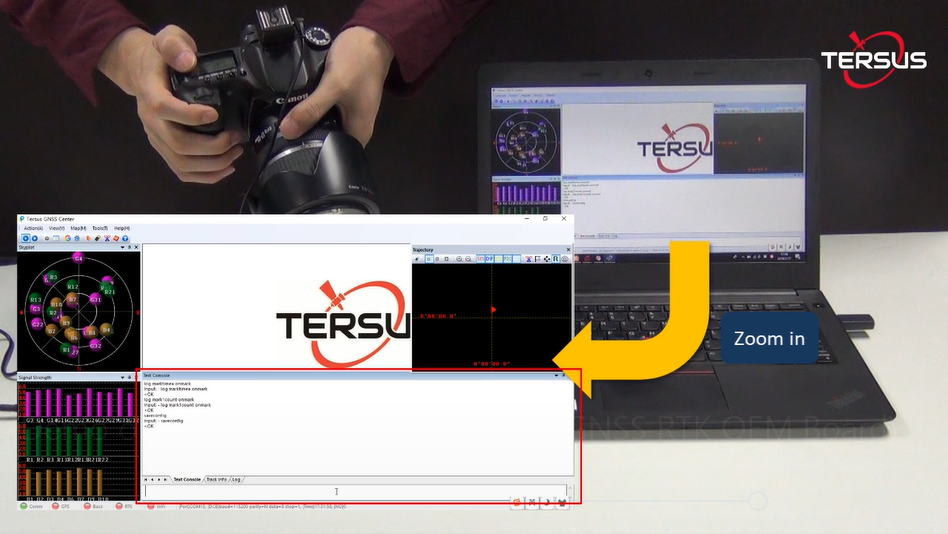
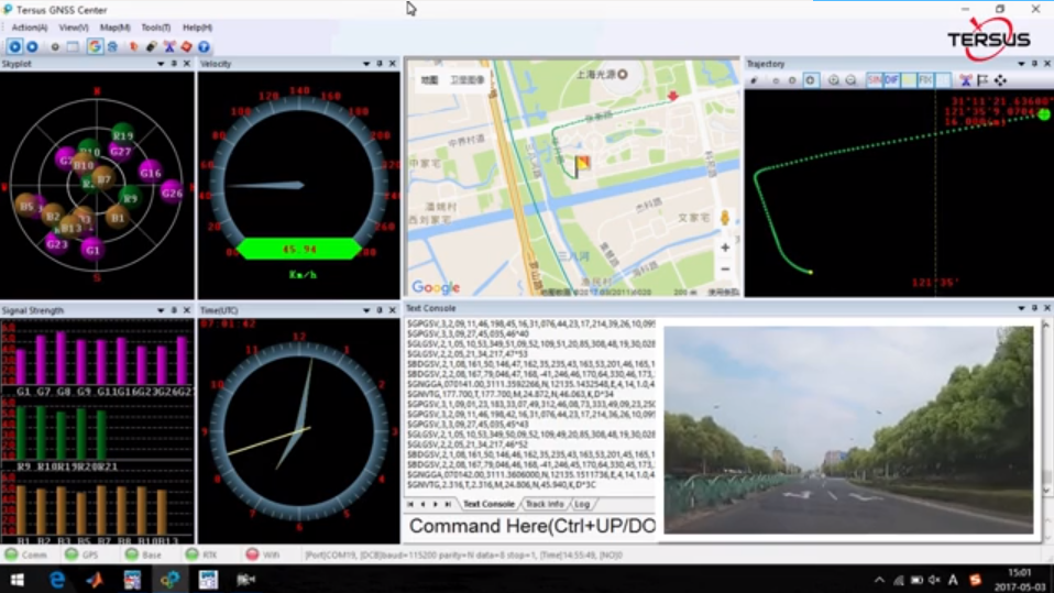
The Tersus GNSS Center is configuration tool for Tersus GNSS products. This software integrates configuration, monitoring, data logging, firmware upgrade and other useful tools. With Tersus GNSS Center, you can communicate over the on-board serial ports, key in commands to configure the board, upgrade firmware, store data, playback data, convert data to RINEX format, display rover’s trajectory in Google/Baidu map, calculate the average position of the base station, view status of the board and positioning results.
For details, please visit: https://www.tersus-gnss.com/product/tersus_gnss_center
Tersus GeoPix integrates the functions of GNSS observation post processing, Event Mark interpolation and Geotagging in EXIF. By clicking one button after input all necessary data, the software provides the result directly as input for image processing software. Tersus GeoPix is a part of Tersus Tool Suite which can be downloaded from Tersus official website.
For details, please visit: https://www.tersus-gnss.com/software
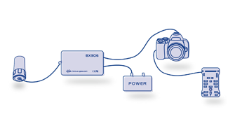
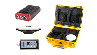
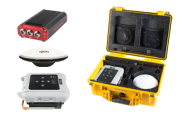
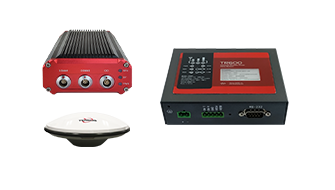
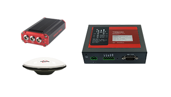
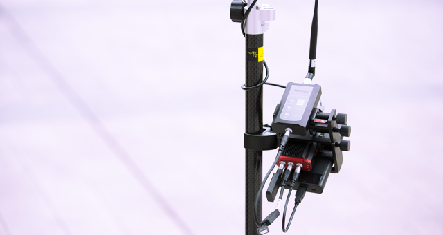
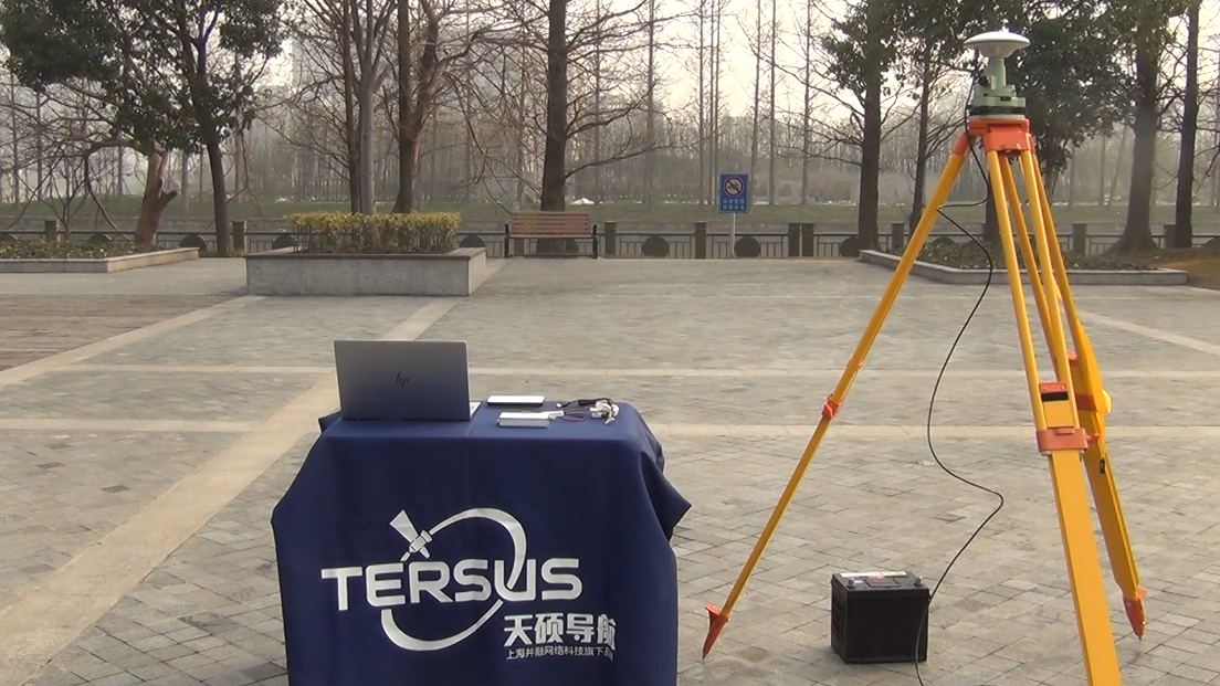
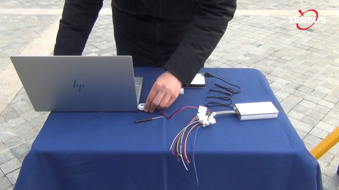
Tersus UAV PPK solution includes BX306 PPK Receiver, AX3705 Helix Antenna (or AX3703 GNSS Aviation Antenna as another option) and Tersus GeoPix Software. BX306 PPK Receiver supports multi-constellations and dual-frequencies. It has in-built 4GB memory (eMMC) for GNSS observation data recoding. Very small and light AX3705 Helix Antenna and AX3703 GNSS Aviation Antenna are designed for UAV applications.
For details, please visit: https://www.tersus-gnss.com/product/uav-ppk-solution
The Tersus PNW software is a high accurate CORS Network management and positioning service software with optimized algorithms independently developed by Tersus GNSS Inc. The software can effectively model errors caused by ionosphere, troposphere and satellite orbit, and precisely estimate correction at the rover. It enables the rovers to achieve fast real-time positioning with centimeter accuracy. The stability and reliability of Tersus PNW software has been approved by maintaining large-scale CORS network.
For details, please visit: https://www.tersus-gnss.com/product/pnw-software
CORS is for Continuously Operating Reference Stations. Tersus offers GeoBee, a GNSS RTK system for CORS station. With centimeter-accurate RTK board inside, GeoBee provides accurate and stable signal reception. Working with choke ring antenna, it can improve the capability of anti-jamming and output high-qualify RTK correction, which is ideal for establishing CORS system and monitoring system.
The Tersus GeoCaster is a Networked Transport of RTCM via Internet Protocol (NTRIP) Caster software which allows GNSS correction data such as RTCM corrections to be repeated and sent to different end users via internet. It supports configurable bases online simultaneously and configurable rovers for one base. The end users involve in various areas including surveying, construction engineering, deformation monitoring, automated vehicle, precision agriculture, Unmanned Aerial Vehicle, machine control, robotics, etc.
For details, please visit: https://www.tersus-gnss.com/product/geocaster
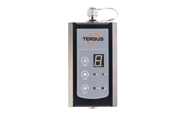
The Tersus GeoBee is a dedicated and cost-effective solution to transmit or receive Ntrip corrections. With Tersus Ntrip Caster Service, Ntrip Modem and David Receiver, the GeoBee opens the possibility for users to transmit Real Time Kinematic (RTK) corrections via Internet (Ethernet or 2G/3G/4G) in a simple, user-friendly way, just using a SIM card or Ethernet cable without any need of a static IP. GeoBee can also work as GNSS Rover to receive RTK corrections from Tersus Ntrip Caster or any CORS service.
For details, please visit: https://www.tersus-gnss.com/product/geobee
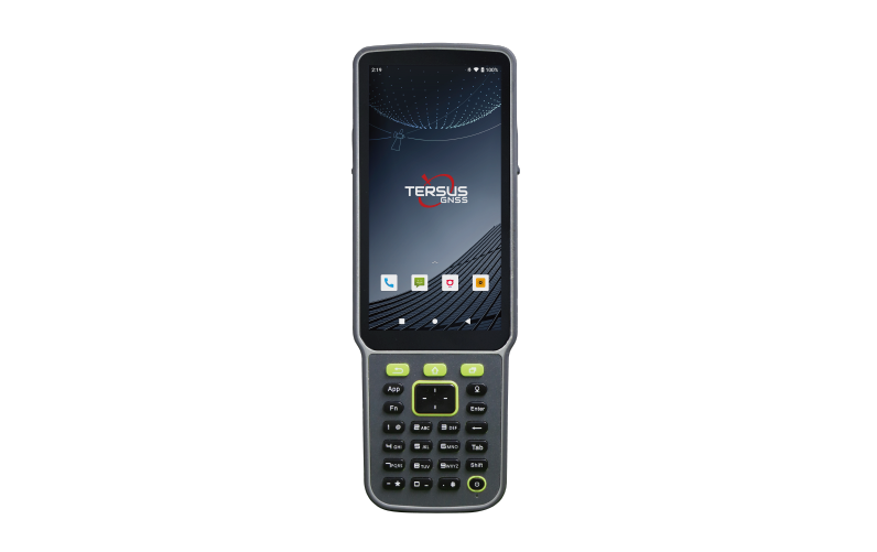
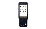
The Tersus TC50 Controller is a rugged multi-functional data controller with design of 5'' HD touch screen and an alphanumerical keypad. Equipped with powerful Octa-core processor and android operating system, it is perfect to adapt with Tersus survey software. With professional IP68 rating, it is robust and reliable for harsh operating conditions.
For details, please visit: https://www.tersus-gnss.com/product/tc50-controller
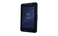
The Tersus TC40 Controller is a rugged smart phone with design of 8'' IPS screen and 1280*800 resolution. Equipped with Android 8.1 mainstream operating system, 8-core 2.0G processor, it is perfect to adapt with Tersus Survey software and run fast. The 9000mAh large capacity battery is detachable, which can work continuously for 10 hours without pressure. The unique rounded corner design and plastic shell are compatible with appearance and protection. With professional IP67 rating, it is robust and reliable for harsh operating conditions.
The Tersus TC30 Controller is a rugged controller with the design of 5'' touch screen and full keypad. Flexible interfaces such as Bluetooth, Wi-Fi, 3G/4G and DB9 serial port make it convenient to connect to GNSS receivers and transceive correction data. Equipped with Windows Mobile operating system, it is perfect to adapt with MicroSurvey FieldGenius software and other field application software. With professional IP67-rated protection, it is robust and reliable for harsh environment.
For details, please visit: https://www.tersus-gnss.com/product/tc30-controller
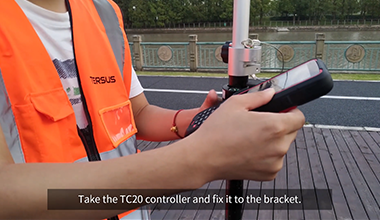
The Tersus TC20 Controller is a rugged smart phone with design of 4.3'' touch screen and an alphanumerical keypad. Equipped with powerful processor, it is perfect to adapt with Tersus Survey software. With professional IP68 rating, it is robust and reliable for harsh conditions.
For details, please visit: https://www.tersus-gnss.com/product/tc20-controller
The T18M is a GNSS controller equipped with an alphanumerical keypad, a 3.7" sunlight readable screen and a powerful processor, which is designed to improve surveyors' productivity.
With a rugged IP54-rated enclosure that can survive 1.2 meter free drops, the T18M is a perfect solution for the harshest operating environments. In addition, the Li-ion, 6500mAh-capacity battery can support prolonged fieldwork.
For details, please visit: https://www.tersus-gnss.com/product/t18m-controller
Nuwa is a survey application software based on Android OS (Operating System), designed by and all rights reserved to Tersus GNSS Inc. Nuwa is simple, easy to use and has a friendly user interface. It is designed to work with David GNSS receiver, Oscar GNSS Receiver and other receivers which support NMEA-0183.
- Supports Bluetooth and USB connection
- Configure Base, Rover and Static Survey
- Graphical Interface with background map (online/import)
- CAD Stakeout, Road Stakeout and Earthwork
- Data Management (import/export multiple formats)
- Various built-in tools
For details, please visit: https://www.tersus-gnss.com/product/nuwa
Generally speaking, there are several main classes of applications that can be used with Tersus David GNSS receivers to attain high-precision positioning details.
- Rover + CORS
- Base + Rover + Radio
- Base + Rover + Tersus NTRIP Caster
- Raw Measurements Collection
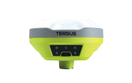
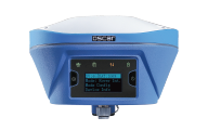
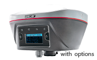
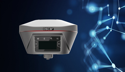
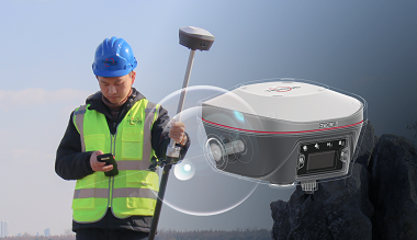
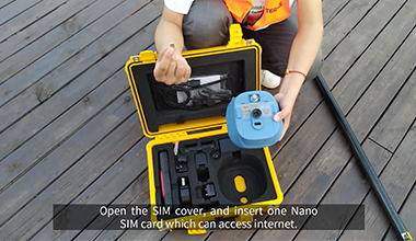
Tersus Oscar GNSS receiver is a new generation of tilt compensation GNSS receiver. Empowered by a high precision inertial measurement unit (IMU) on Ultimate version, this kind of calibration-free tilt compensation is immune to magnetic disturbances. Oscar gives a surveyor unprecedented flexibility and efficiency - holding the survey pole upright is no longer necessary. With an internal high-performance multi-constellation and multi-frequency GNSS board, Oscar GNSS Receiver provides high accuracy and stable signal detection.
The built-in high-performance antenna can speed up the time to first fix (TTFF) and improve anti-jamming performance. With a Nano-SIM card inserted in Oscar, it can access Internet, transmit and receive correction data through 4G/WiFi network. The built-in UHF radio module supports long distance communication. The built-in large capacity battery is detachable and can display power level. Two batteries support up to 16 hours of fieldwork in 4G/3G/2G network and Rover radio mode. Oscar can be easily configured with 1.54'' interactive screen on Ultimate and Advanced versions. The rugged housing protects the equipment from harsh environments.
For details, please visit: https://www.tersus-gnss.com/product/oscar_gnss_receiver
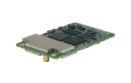
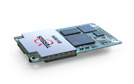
The Tersus BX40C is a compact GNSS RTK board with full constellation tracking for providing cm-level accuracy for positioning. In-built 8GB memory makes data collection easy. It features compatibility with other GNSS boards in the market via flexible interfaces, smart hardware design, and commonly used log/command formats.
For details, please visit: https://www.tersus-gnss.com/product/bx40c